All across America, cities are investing in new transit lines. Which of these routes will make the biggest impact by attracting large numbers of new riders? A landmark report from a team of researchers with the University of California at Berkeley identifies the factors that set successful transit investments apart from the rest.
The secret sauce is fairly simple, when you get down to it: Place a transit line where it will connect a lot of people to a lot of jobs and give it as much grade-separated right-of-way as possible, and it will attract a lot of riders.
What makes the work of the Berkeley researchers, led by Daniel G. Chatman, remarkable is that it compiles decades of real-world data to predict how many people will ride a given transit route. Their conclusions should bolster efforts to maximize the effectiveness of new transit investments.
The report authors examined 140-plus factors to build these ridership models, based on data collected from 55 "fixed guideway" transit projects, including rail and bus rapid transit routes, built in 18 metropolitan areas between 1974 and 2008.
They found the success of a transit project is almost synonymous with whether it serves areas that are dense in both jobs and population and have expensive parking -- in short, lively urban neighborhoods. In the report's model, the combination of these factors explains fully 62 percent of the ridership difference between transit projects.
Surprisingly, the only design factor that seemed to have a significant effect on ridership was whether the route is grade-separated (in a tunnel or on a viaduct). In isolation, transit speed, frequency, or reliability did not have significant impacts, but the great advantage of grade-separated routes is that they can run quickly and reliably through high-density areas.
While it may seem like common sense to put transit routes where they will connect people to jobs, agencies don't always choose the best routes -- often opting for expedience over effectiveness. Salt Lake City's FrontRunner commuter rail service, for instance, very closely parallels a newly widened I-15, and many stations are located in low-density industrial or residential areas. Ridership has fallen short of expectations.
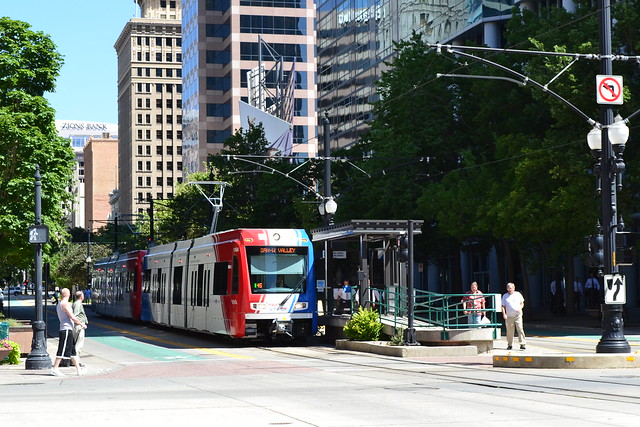
Elsewhere in Salt Lake City, the authors identify the University/Medical Center Trax light rail route as a good example of a high-ridership transit project. It connects major high-wage job centers -- notably the university, its hospital, and downtown -- and also many leisure destinations like museums, sports stadiums, the state fair park, concert halls, and nearly half of the region's hotel rooms. Locals have embraced light rail as an alternative to costly parking, as well: Parking demand on the growing University of Utah campus has fallen 30 percent since the route opened. The route carries 78 percent more riders than initially projected.
Planners have long known that density is linked to higher transit ridership, but until now they have largely relied on a 1977 report by Boris Pushkarev and Jeffrey Zupan for the Regional Plan Association, which defined basic thresholds below which different kinds of transit investments would not be cost-competitive. The new report adds a generation's worth of experience with transit investments to not only update and flesh out the older research, but to understand which aspects of density and urban form interact to create places where transit can thrive.
The Berkeley researchers' goal was to create an easy-to-use ridership forecasting model, built with data collected from finished projects across the country, that can help planners evaluate both individual transit routes and systemwide changes. Planners interviewed by the research team stated that "transit planning was an art and a political process, not a science," and that tools should make it easier to evaluate proposed transit improvements.
Pulling back the lens, the researchers also found that regions where many people ride transit have several factors in common. Transit systems that reach concentrations of high-wage jobs and leisure jobs (in shops, restaurants, arts, and entertainment), and that serve metro areas that are simultaneously large and congested, are likely to draw more transit riders than systems that don't.
One unanticipated finding was that access to these specific kinds of jobs, rather than to jobs in general, is a hallmark of transit-oriented metro areas. The authors suggest that perhaps easy transit access to high-wage jobs draws "choice" riders out of cars and onto transit. Meanwhile, leisure jobs clustered around transit stations could be a proxy for "24-hour" mixed-use urban neighborhoods that draw transit riders throughout the day.
The results of the report are also available as a computer model, downloadable as an Excel spreadsheet [XLS], that "balances simplicity with technical accuracy, and could be used to augment" current practices in transit planning. Anyone with access to some basic information about a proposed transit line and data about the areas around it (most of it readily obtainable from the Census) can use the model to generate ridership estimates for the line and for the entire transit system.
