
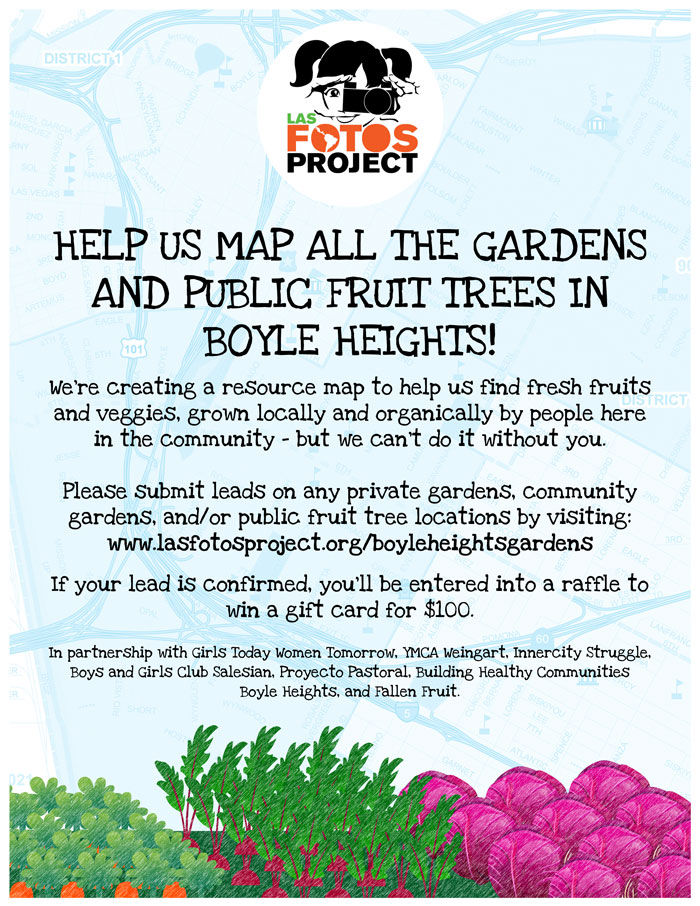
Las Fotos Project Looking for Your Help to Build Community Gardens Map
In an effort to create an online and physical map of community gardens throughout Boyle Heights, the Las Fotos project is asking for your help. The map will include original work by the young women who participate in the program. You can submit leads on any public or private gardens or fruit trees by clicking here. If your lead is confirmed, you could win a $100 gift card.
Las Fotos Project has since worked with Latina youth throughout Southern California, and has developed partnership with national and international nonprofit organizations and schools to expand the movement of empowering Latina youth through photography and self-expression. It was founded in 2010 by Los Angeles-based photographer Eric V. Ibarra after seeing a need for teenage girls throughout Los Angeles to have a skill that could help build their confidence and self-esteem.
“Las Fotos Project’s student photographers are creating a resource map with all the gardens and public fruit trees for the community of Boyle Heights,” writes Natalie Franco, a professional advisor and advisor for this project. “We need your help! Please submit your leads to any gardens or public fruit trees here: www.lasfotosproject.org/boyleh
Over the course of ten weeks, 14 students will use Geographic Information System (GIS) mapping to document the location and size of all gardens throughout the community. The map will distinguish between gardens and green spaces on public property, shared community gardens, and school gardens, and will distinguish them by size: small medium, or large.
A printed version of the map will be premiered at the Boyle Heights Primavera Festival and distributed throughout the Boyle Heights community. The map itself will be an environmental education and resource tool by providing residents with information on the location of gardens, where to join in on gardening, and help bring about a community-wide awareness of community gardens.
Las Fotos is partnering with YMCA, the Boys and Girls Club, Girls Today Women Tomorrow, Proyecto Pastoral, Inner-city Struggle and Building Healthy Communities Boyle Heights on the community gardens map project. Interested in reading more about Las Fotos projects please read “Nature Double Exposed” and “La Virgen” by Kris Fortin.

Streetsblog has migrated to a new comment system. New commenters can register directly in the comments section of any article. Returning commenters: your previous comments and display name have been preserved, but you'll need to reclaim your account by clicking "Forgot your password?" on the sign-in form, entering your email, and following the verification link to set a new password — this is required because passwords could not be carried over during the migration. For questions, contact tips@streetsblog.org.


