Grab Your Kid, Grab Your Bike…and Ride With Us On Father’s Day
They're ba-ack...
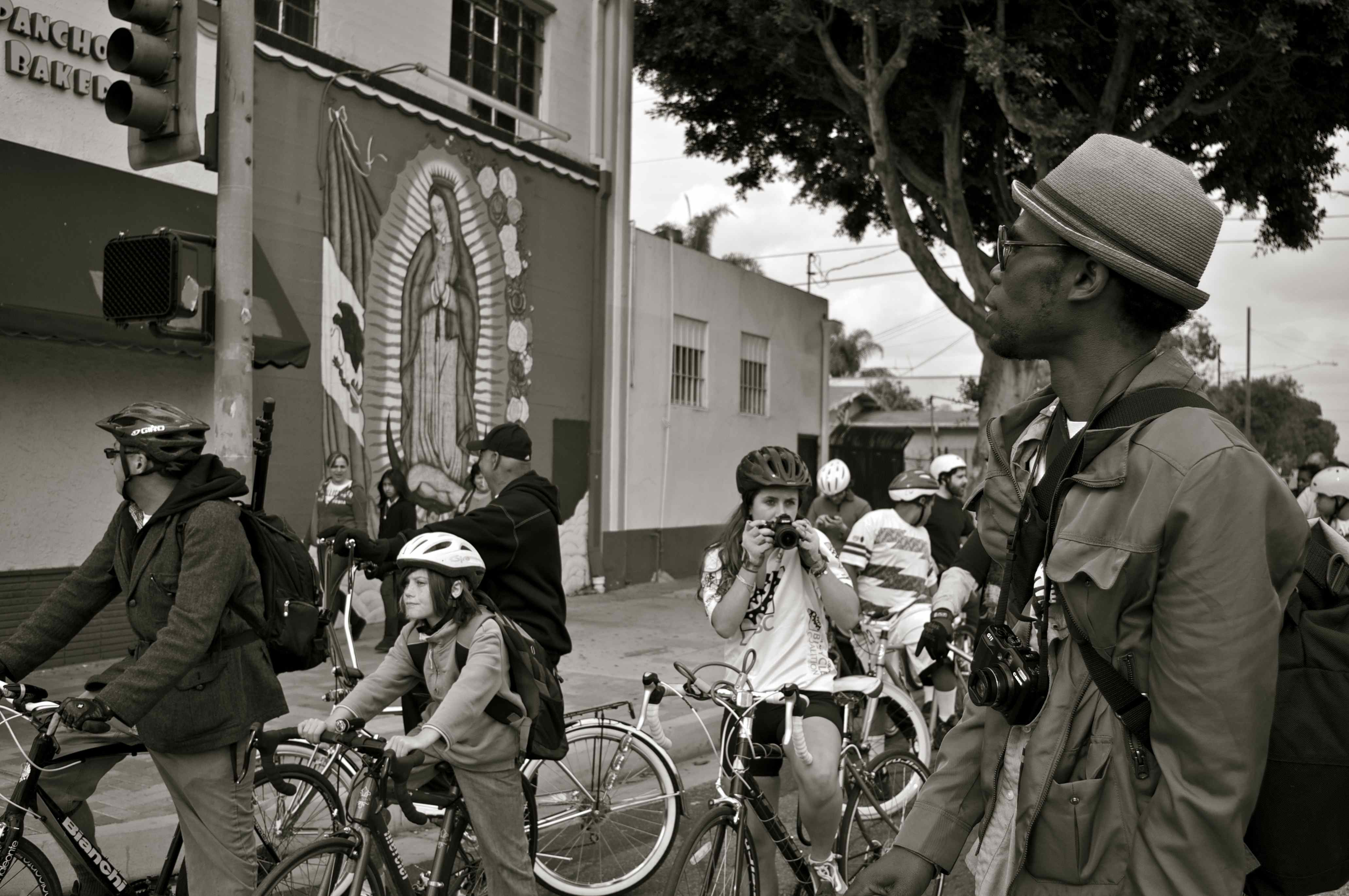
The folks behind Ride South L.A. have teamed up again with the East Side Riders (ESR) and T.R.U.S.T. South L.A. to help you tour the Florence-Firestone and Watts areas using the crowd-sourced map created from a ride earlier this year. Riders will meet at Augustus Hawkins Natural Park at 10 a.m. on June 17th, roll south towards the Watts Towers, and make a pit stop for water, snacks, and a surprise at the WLCAC, before heading back up to the starting point. Event information is here.
"Initially, we weren't planning to organize another ride of the same route and we thought the map would be for ride-it-yourselfers," said François Bar, a Professor of Communication at USC and core member of the ParTour team. "But at every event where we handed out the map, from CicLAvia to TEDxUSC and the Bike Week launch, people kept asking, 'When is the next ride?'"
People in the community have been asking that same question.
Although bikes are a staple with commuters and fixies have exploded in popularity with the youth in the area, recreational riding is still a somewhat novel activity. Safety concerns and lack of access to bikes has kept many from being able to take to the streets for fun.
Hoping to inform the community about the possibilities for cycling in the area and spark greater participation from residents this time, John Jones III of the ESR and I spent several hours canvassing the route, handing out maps, and encouraging people to join in the ride. Most people were interested to learn more. Some of the youth we spoke with were excited about the idea but heartbreakingly lamented that they didn't have bikes and asked if we could get them one.
While the production of a map obviously can't produce bikes for those kids out of thin air, its creation has been part of the momentum that has been building for cycling in South L.A. this year. Drawing attention to both the beauty and the needs of the area through events like the one this Sunday, the owner of the Watts Cyclery and groups like the ESR and the newly formed YO Watts Rydaz may be able to build more support for their efforts to launch co-ops, service the community, and bring more people and business to the area.
This fits well with the goals of the Ride South L.A. team. They use their map as an argument for the future of South Los Angeles. They want people to know that not only is it possible to bike to the Watts Towers but that the route can connect riders to organizers fighting for redevelopment, businesses that support social change, and opportunities to take action.
Better yet, the map is a work in progress. The team invites participants to send them new pictures about what else in the area they think should be featured and included, should there be an updated version of the map.
See you Sunday!
Stay in touch
Sign up for our free newsletter
More from Streetsblog Los Angeles

This Week In Livable Streets
Bike Month continues, Metro 91 Freeway widening, Destination Crenshaw, Culver City Bus, Santa Monica MANGo, Metro bike lockers, Metro Sepulveda Transit, and more

San Fernando Valley Bus/Bike Updates: G Line, Roscoe Bus Lanes, Laurel Canyon Bike Lanes
Short newly protected bike lane on Laurel Canyon Blvd, extensive NSFV bus improvements under construction this month, and scaled-back G Line plans should get that project under construction this summer