Monrovia Seeks Input on Draft Bike Master Plan
The city of Monrovia has a new draft Bicycle Master Plan available to peruse on its website. The new plan updates the city’s earlier bike plan, approved in 2016.
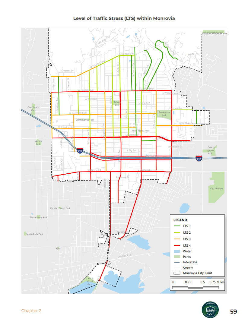
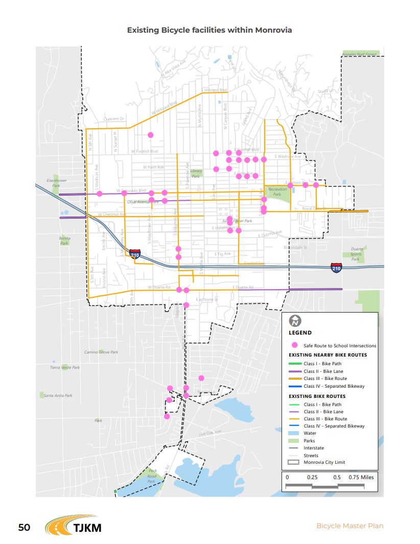
The plan calls for about 36 miles of bikeways. Roughly 13.5 miles would be higher quality: paths (off-street – class I) and protected lanes (class IV). The other 22 or so miles would be unprotected bike lanes and routes, where cyclists share streets with drivers.
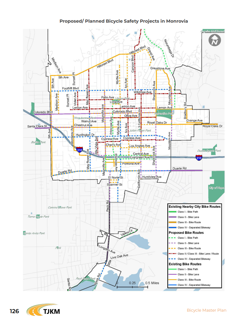
It’s worth noting that the plan prescribes protected bikeways on Monrovia’s busiest streets: Duarte Road (1.94 mi), Huntington Drive (2 mi), Foothill Boulevard (2 mi), Mayflower Avenue (0.9 mi), Myrtle Avenue (2.3 mi), and a fraction of Peck Road (0.4 mi).
These facilities align well with Monrovia’s traffic stress map and greatly improve on the city’s existing bike infrastructure. These bikeways would connect commuters from each of Monrovia’s quadrants to the city’s Metro A Line station, as well as its downtown district.
The city is accepting public comment on the draft plan until this Friday, March 27. Email comments to ssousa@monroviaca.gov
There is also a virtual workshop taking place tomorrow evening at 6 p.m. March 25. Register here.
Streetsblog’s San Gabriel Valley coverage is supported by Foothill Transit, offering car-free travel throughout the San Gabriel Valley with connections to the A Line Stations across the Foothills and Commuter Express lines traveling into the heart of downtown L.A. To plan your trip, visit Foothill Transit. “Foothill Transit. Going Good Places.”Sign-up for our SGV Connect Newsletter, coming to your inbox on Fridays!

Read More:
Streetsblog has migrated to a new comment system. New commenters can register directly in the comments section of any article. Returning commenters: your previous comments and display name have been preserved, but you'll need to reclaim your account by clicking "Forgot your password?" on the sign-in form, entering your email, and following the verification link to set a new password — this is required because passwords could not be carried over during the migration. For questions, contact tips@streetsblog.org.