
Metro Approves Rail-to-Rail Walk/Bike Facility, Groundbreaking Expected Next Month
Yesterday, the Metro board approved getting construction underway on a long-anticipated South L.A. multi-use path project and set the groundbreaking for February 28.
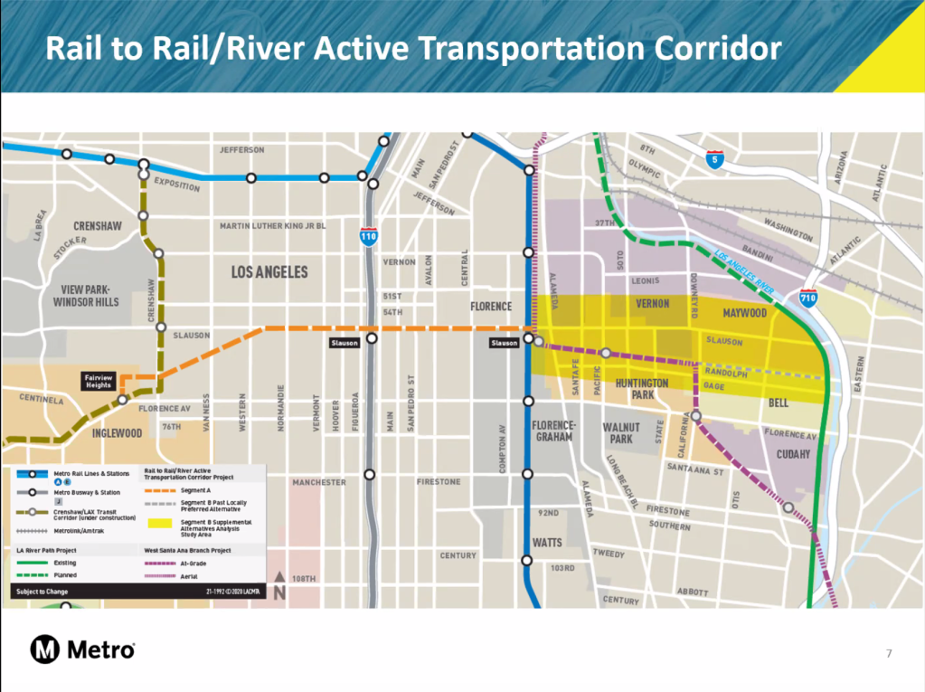
The Rail-to-Rail Active Transportation Project – the initial phase (Segment A, above) of a longer Rail-to-River bike/walk route that will eventually connect South L.A. to the L.A. River – will convert a currently unused rail right-of-way (ROW) into a 30′-wide linear park, with landscaping, lighting, benches, new crosswalks, curb ramps, ped/bike crossing signals, and medians at many intersections.
The 6.4-mile segment will extend from the Slauson Avenue Metro A (Blue) Line Station to the Fairview Heights Station (Redondo Boulevard at West Boulevard) at the under-construction Metro Crenshaw/LAX Line. It will also connect to the Metro J (Silver) Line bus rapid transit Slauson Station, and numerous bus lines. The bulk of the multi-jurisdiction facility sits within the city of L.A., but connects with Inglewood and Florence-Firestone (unincorporated L.A. County) on either end.
Originally conceived as an active transportation corridor facilitating transit connections for bike commuters and those on foot, the path also will bring a much needed space for play, recreation, wellness, and mobility to one of L.A.’s more park poor regions. The intersection upgrades should have the added benefit of improving safety for cyclists and pedestrians moving across, not just along, the dangerous corridor.
______
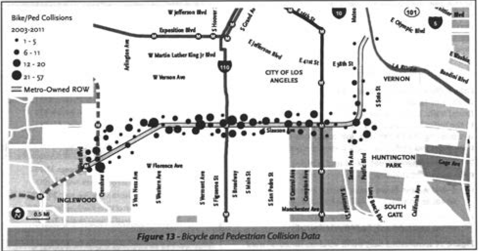
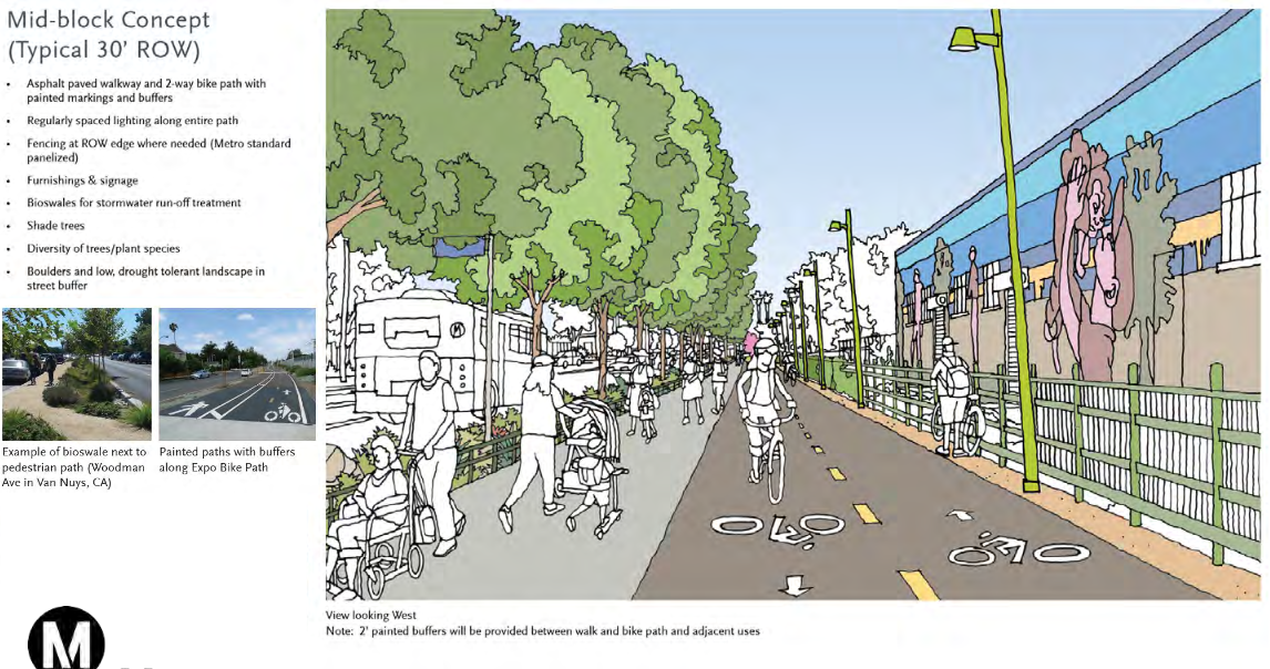
The project ROW runs along the north side of Slauson Avenue, then cuts diagonally southwest, just below Hyde Park Avenue. These two sections have distinct characteristics.
The eastern portion of the ROW is immediately adjacent to five-plus lanes of the heavily trafficked corridor.
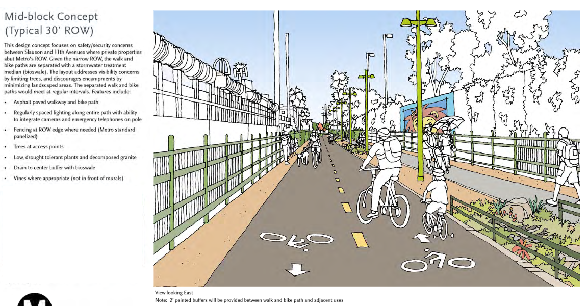
Further west, the ROW is somewhat more confined, running between residential zones and industrial buildings.
Preliminary designs produced in 2016 indicated that along the central segment, a buffer would be created between path users and the steady stream of trucks and cars that rumble through the corridor at all hours.
Because such a buffer won’t be needed where the path heads southwest and runs between private properties, there will be more room for separate biking and walking paths. Here, lighting, landscaping, emergency phones, and connectivity with cul-de-sacs are expected to help with both accessibility to the path and a sense of safety.
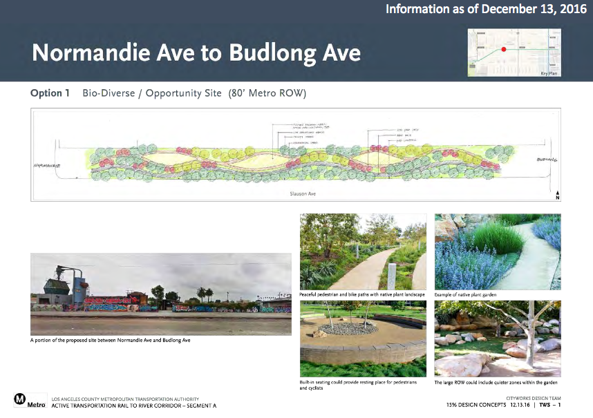
Where feasible along the corridor, landscaping will help make the path more inviting to all users.
Metro first secured partial project funding via a 2015 federal TIGER grant, for which the Board authorized the allocation of up to $10.8 million in hard-match funds. Metro then also matched funds to the $8.3 million state Active Transportation (ATP) grant it received and cobbled together the rest with L.A. County Measure W, and other county funds – plus some Metro Measure R sales tax funding.
With monies finally in hand, construction had been expected to get underway in 2018, but the costs of the three design/build proposals Metro received far exceeded its original proposed budget.
Metro subsequently changed the project delivery method to design/bid/build in order to minimize the risks associated with having to seek city approvals as well as some of the other factors that drove the bidders’ projected costs so high. That meant that instead of the contractor and design consultant producing the conceptual drawing and approved-for-construction design, Metro completed a design in-house that was fully approved for construction before potential contractors were invited to bid on it.
To make the financing work out, the city of Los Angeles stepped up to contribute $30 million in services along the ROW. As rail right-of-ways generally lack curbs, sidewalks, drainage, etc., the city will be adding these where applicable.
The Metro board also approved the $115 million life-of-project budget [staff report] which lets the agency move forward with a current construction bid in hand.
Though the funds have mostly been lined up, the budget spreadsheet indicates there is still a shortfall of around $58 million. The staff report notes that Supervisor Holly Mitchell is working to contribute $15 million (in additional county funds) to the project.
Metro has already spent $8 million in contamination clean-up costs. These sorts of clean-up costs are common in these rail/industrial corridors; more could arise.
Metro has plans to host a groundbreaking next month – Monday, February 28. The facility is expected to open around 2023-24.

Read More:
Streetsblog has migrated to a new comment system. New commenters can register directly in the comments section of any article. Returning commenters: your previous comments and display name have been preserved, but you'll need to reclaim your account by clicking "Forgot your password?" on the sign-in form, entering your email, and following the verification link to set a new password — this is required because passwords could not be carried over during the migration. For questions, contact tips@streetsblog.org.


