Pasadena Studying Four North-South Bike Boulevard Corridors

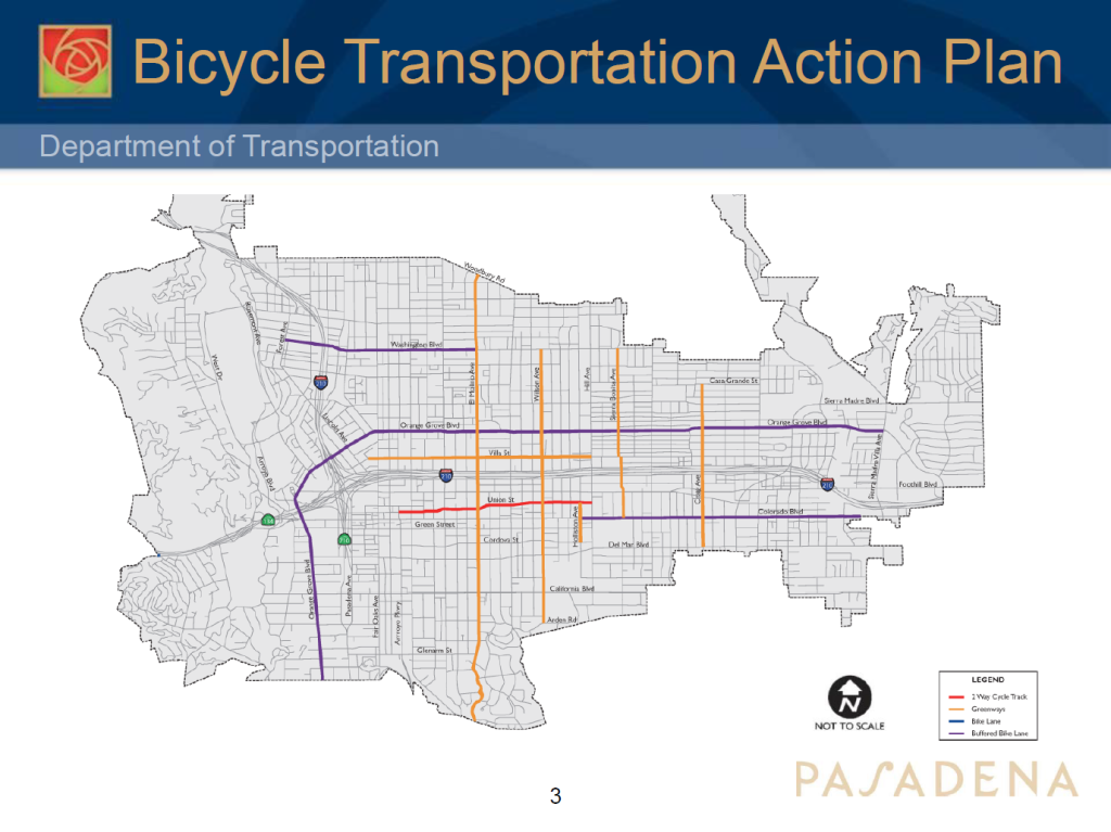
The city of Pasadena is making progress on a vision to calm traffic on four corridors in the City.
The city is looking to implement bike boulevards on El Molino, Wilson, Sierra Bonita, and Craig Avenues. An update on the study, also called the Greenway Traffic Analysis and Implementation, was presented to the Pasadena’s Transportation Advisory Commission on April 22.
The improvements on El Molino Avenue would stretch to the north and south borders of the city; Wilson Avenue would stretch from Washington Boulevard to near the southern border at Arden Road; Sierra Bonita Avenue would go from Washington Boulevard to Colorado Boulevard; and Craig Avenue from Casa Grande Street to the city’s southern border at Del Mar Boulevard. These areas being considered for neighborhood greenways/bike boulevards could receive traffic calming, lower speeds, and intersection improvements to facilitate easier crossings.
Planning for these corridors has been in the works since as early as 2015 when the city released its Bicycle Transportation Plan, which had the goal to build a bikeway network that would put a bikeway within a quarter mile of every residential neighborhood. A feasibility study included in the BTAP identified ten corridors — including El Molino, Wilson, Sierra Bonita, and Craig Avenues — that could be a good fit for protected bike lanes, buffered bike lanes, and bike boulevards.
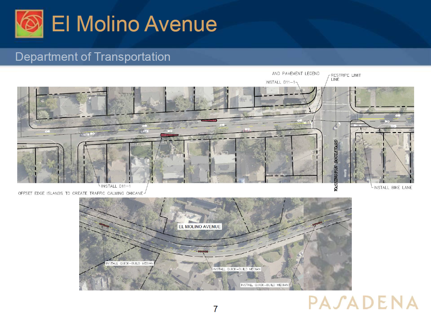
The study of El Molino, Wilson, Sierra Bonita, and Craig Avenues started in 2019 when consultants KOA were contracted to analyze the impacts, feasibility, benefit, and cost of their bike boulevard projects. Some of the infrastructure improvements proposed include bulb outs, quick build medians, bike crossing at intersections, flashing light beacons, roundabouts, bicycle boxes for turning, and curb extensions.
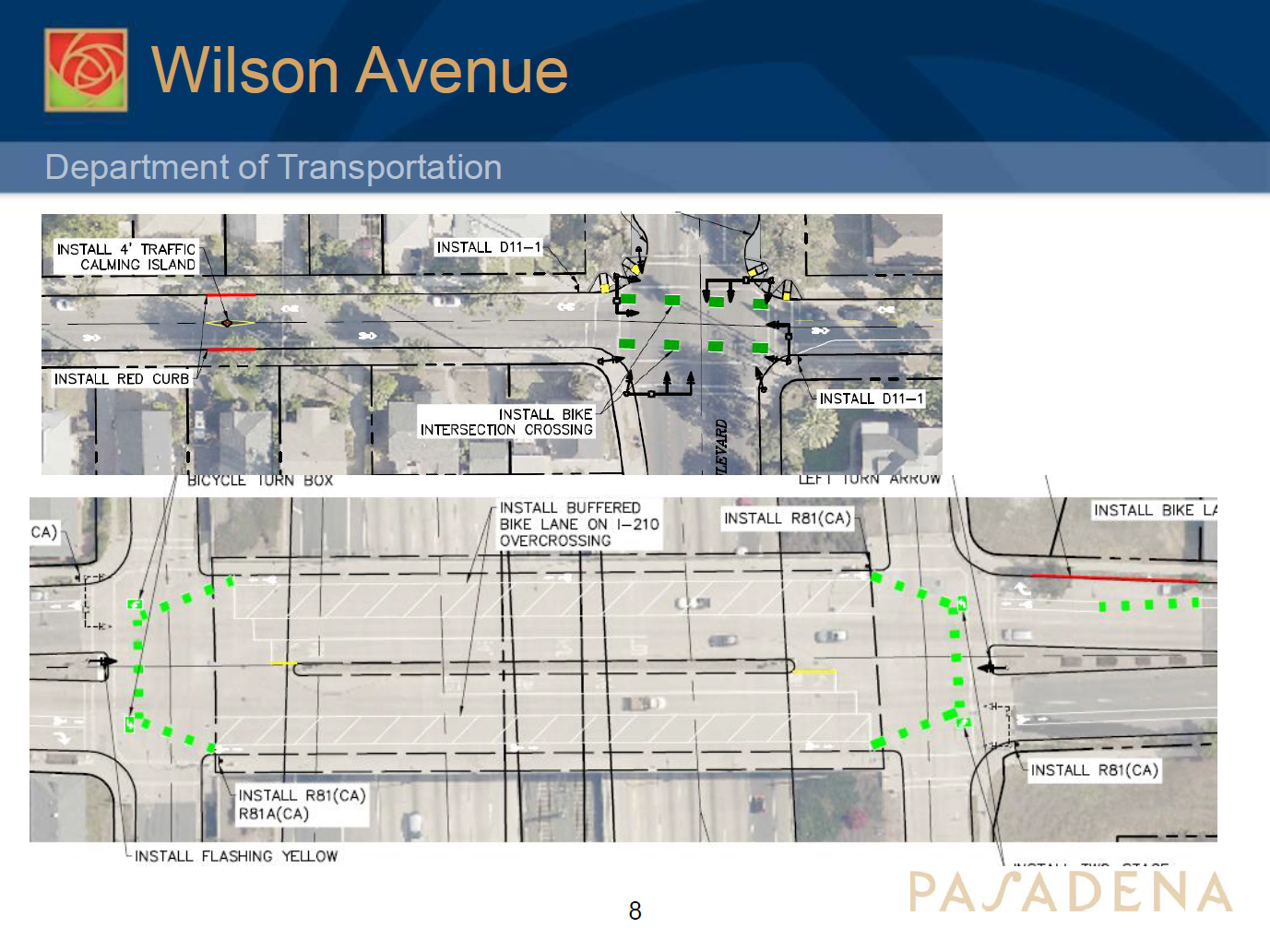
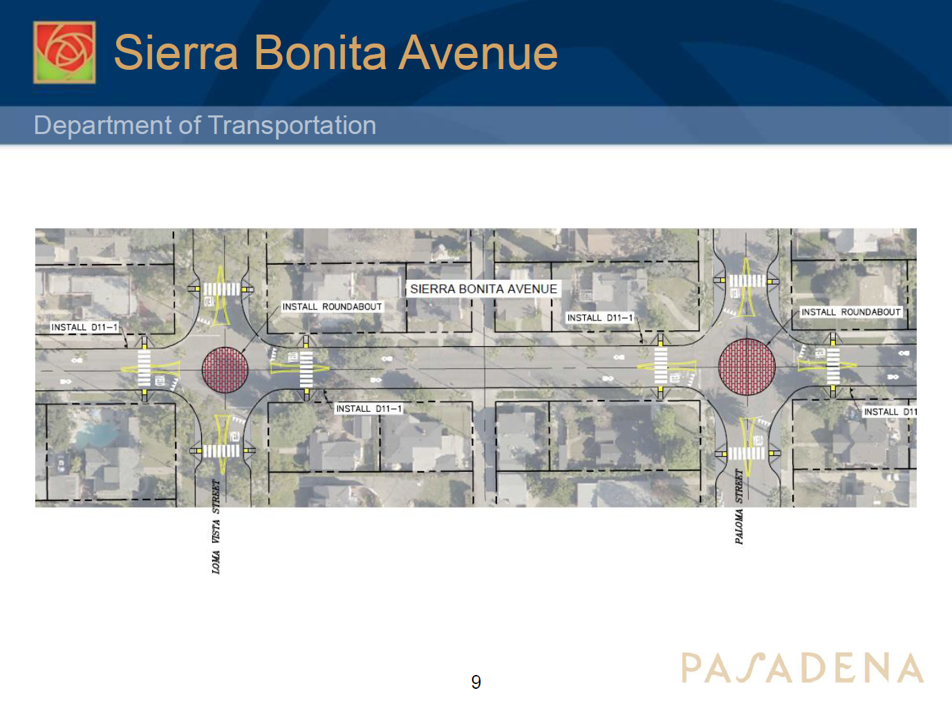
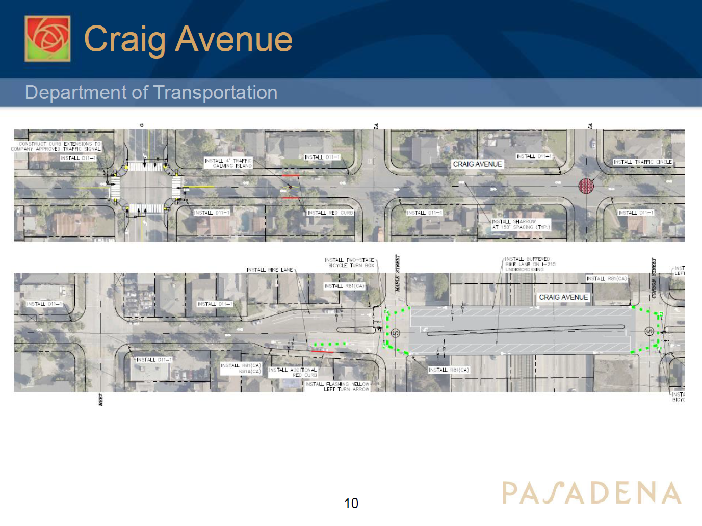
This study also is developing an implementation plan which would rank each corridor by how well it would reduce crashes, how the corridor would fill out the bicycle network, its ability to access open space, schools and existing bikeways; its benefits to areas burdened by unhealthy environments; cost; and impacts to traffic and parking.
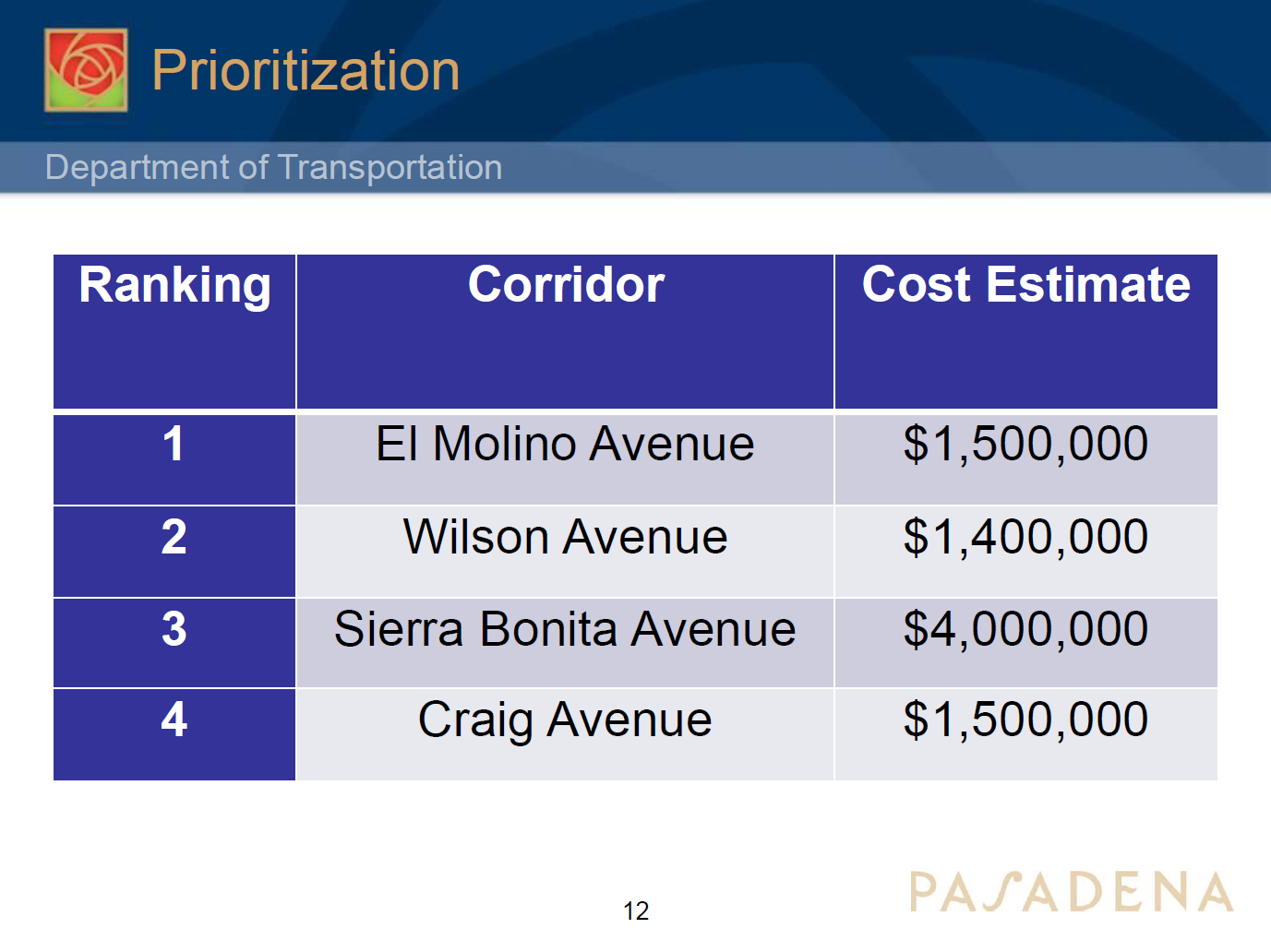
Pasadena’s department of transportation staff expect to share findings of the study with the public this coming summer. From there, staff will be getting feedback on the findings, the project concepts, and refine the work to be eventually developed as future capital improvement projects.
SBLA San Gabriel Valley coverage, including this article and SGV Connect, is supported by Foothill Transit, offering car-free travel throughout the San Gabriel Valley with connections to the new Gold Line Stations across the Foothills and Commuter Express lines traveling into the heart of downtown L.A. To plan your trip, visit Foothill Transit. “Foothill Transit. Going Good Places.”
Sign-up for our SGV Connect Newsletter, coming to your inbox on Fridays.

Read More:
Streetsblog has migrated to a new comment system. New commenters can register directly in the comments section of any article. Returning commenters: your previous comments and display name have been preserved, but you'll need to reclaim your account by clicking "Forgot your password?" on the sign-in form, entering your email, and following the verification link to set a new password — this is required because passwords could not be carried over during the migration. For questions, contact tips@streetsblog.org.