Eyes on the Street: Recently Widened Soto Street Bridge over Valley Blvd
The newly widened Soto Bridge is disappointing from a walking, transit and bicycling perspective - and the city plans more widening on Soto just north of the bridge project
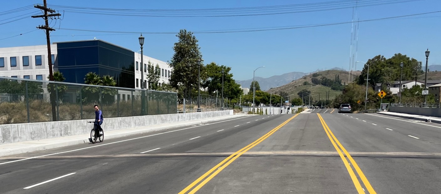
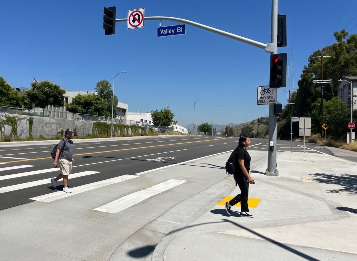
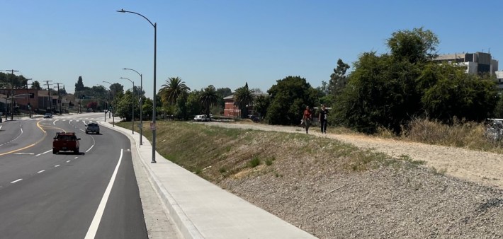
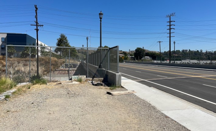
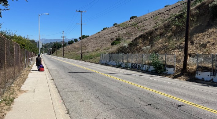
The city widened the Soto Street Bridge, but missed a lot of opportunities to make the facility safer and more welcoming for people on foot, bike, and transit. Photos by Joe Linton/Streetsblog

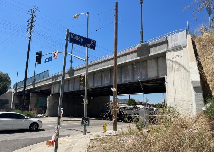
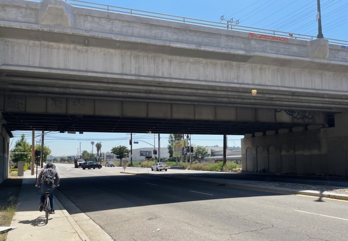
Los Angeles recently completed widening the Soto Street Bridge over Valley Boulevard. The bridge is located about three miles east of downtown L.A., straddling the L.A. City neighborhoods of Boyle Heights, El Sereno, and Lincoln Heights. The city Bureau of Engineering's $17.2 million Soto Street Widening over Valley Blvd. and UPRR [Union Pacific Railroad] project was completed in June 2023.
The project widened the bridge by 25 feet. The historic span remained in place, with additional width extending the structure westward.
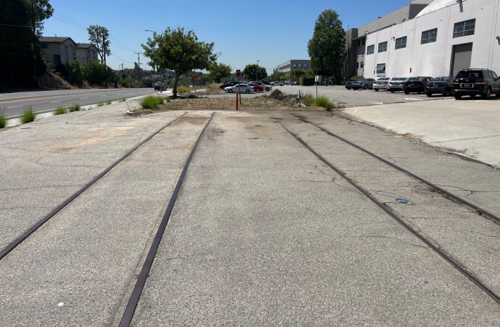
The Soto Street Bridge project removed an unused adjacent rail bridge which formerly served the Pacific Electric Pasadena Short Line.
The bridge widening project did not add any more new car lanes to the bridge, but widened the four existing travel lanes, added a striped median, added/lengthened turn lanes south of the bridge, and added bike lanes.
The bridge widening project is disappointing from a walking, transit, and bicycling perspective.
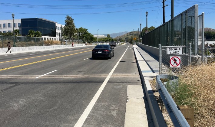
Though the bridge itself includes sidewalks on both sides, the $17 million expansion managed to leave sidewalks off of the bridge approach on the east side. Signage indicates pedestrians are supposed to use only the continuous sidewalk on the west side of the bridge.
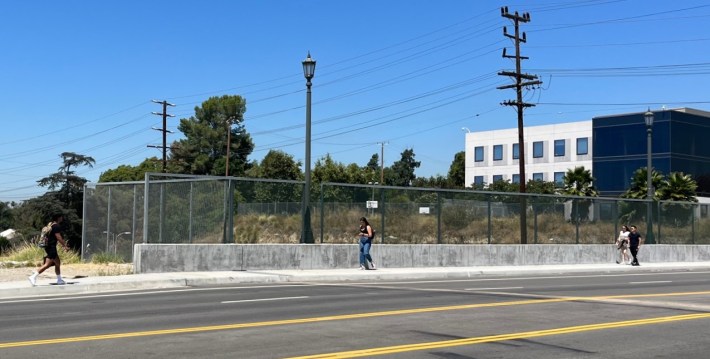
DASH bus stops there have no shelters, no seating, no shade trees, all of which should have been included in a multi-million dollar infrastructure project.
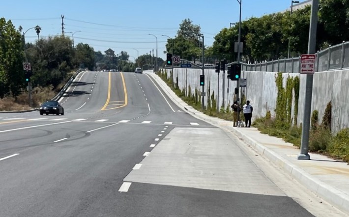
The project also worsened transit conditions by removing a couple of shade trees (and one empty tree well) at the bus stops. A project designed to benefit transit riders and pedestrians could perhaps have removed the slip lane for northbound drivers continuing straight from from Valley onto northbound Soto.
According to the city's Mobility Plan, this portion of Soto was approved for new protected bike lanes, but the city implemented basic unprotected lanes instead.
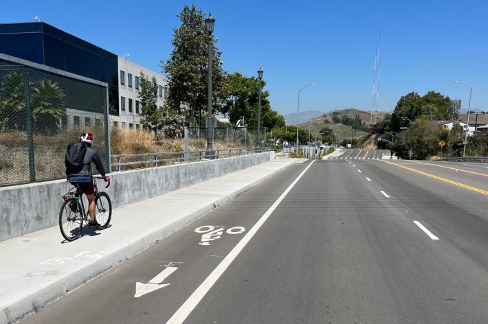
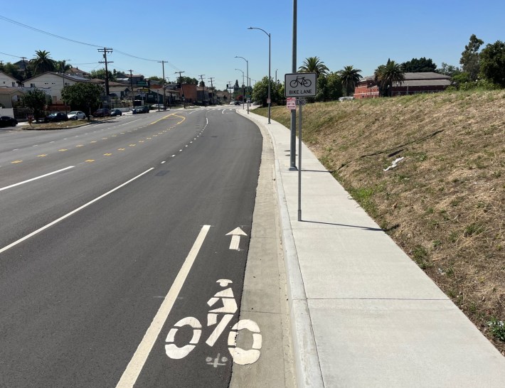
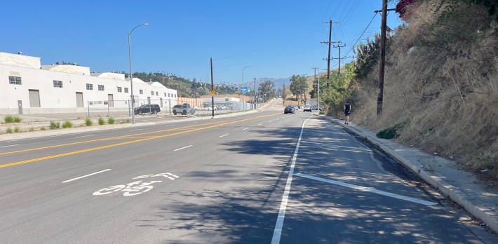
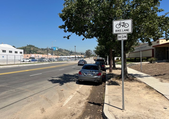
The new Soto bike lanes extend nearly a half-mile from Alcazar Street to Multnomah Street. The city decided to omit the northbound bike lane for about 700 feet north of the bridge (instead just installing sharrows). This is at a very short pinch point, where Soto narrows to 48 feet across. With no parking, and four car lanes, the city couldn't find space for a continuous bike lanes - which would fit if the city used 10-11 foot car lanes. (Ten-foot lanes are not uncommon in Los Angeles, especially in older parts of the city; it's unclear why the city used wider car lanes on Soto.)
The Soto project's big missed opportunity is the historic rail right of way, which has long been seen as a potential bike/walk path connecting from Hazard Park to El Sereno.
And the city is not done widening Soto Street.
Immediately north, a second project, Soto Street Widening from Multnomah Street to Mission Road [webpage, info sheet] would spend $23 million to widen Soto, adding one more lane for drivers. It would require partial right-of-way acquisitions from 13 hillside parcels east of Soto.
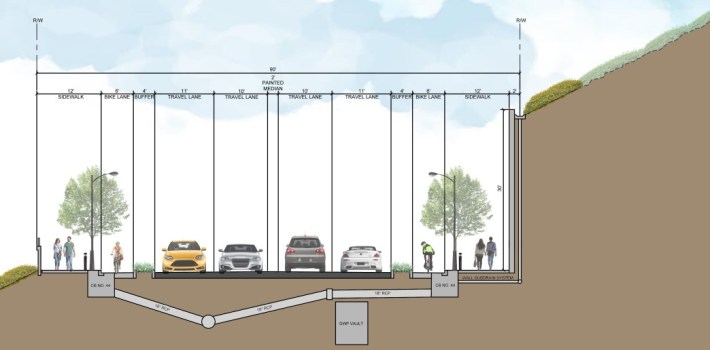
That future widening is already environmentally approved. The project would add a large retaining wall, a missing sidewalk, a painted median, and protected bike lanes.
The city doesn't need to widen Soto to stripe basic bike lanes on that stretch. It is currently 40 feet wide, with three lanes for car traffic and no on-street parking.
Stay in touch
Sign up for our free newsletter
More from Streetsblog Los Angeles
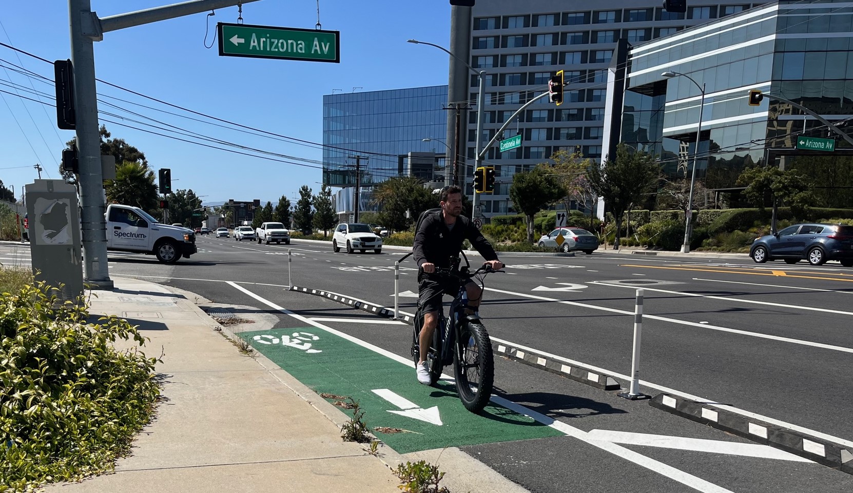
Eyes on the Street: Recent Centinela Bike Lanes in Culver City
The new partially-protected Centinela facility is a welcome safety upgrade for a stretch that long lacked any type of bikeway, but the area remains not all that bike-friendly

This Week In Livable Streets
Bike Month continues, Metro 91 Freeway widening, Destination Crenshaw, Culver City Bus, Santa Monica MANGo, Metro bike lockers, Metro Sepulveda Transit, and more