PathPath
  • Contact
  • Staff & Board
  • Our Funders
  • Ways to Give
  • Comment Moderation Policy
  • Streetsblog Los Angeles Editorial Independence Policy
  • Donor Transparency Policy
    Follow Us:
  • Facebook
  • Twitter
Streetsblog Logo
    • HOME
    • USA
    • NYC
    • MASS
    • LA
    • CHI
    • SF
    • CAL
    • STREETFILMS
    • DONATE
Streetsblog LA Logo
  • Eastside
  • South LA
  • Streetsblog CA
  • Eric Garcetti
  • MyFigueroa!
  • Legacy of Redlining
    Follow Us:
  • Facebook
  • Twitter

Kristopher Fortin

@lapaperboy
Streetsblog California contributor, covering news in Orange County.

Recent Posts

SGV Connect 91 – Damien and Kris, One Last Time

By Damien Newton and Kristopher Fortin | Mar 29, 2022 | No Comments
SBLA SGV reporter Kris Fortin is moving on to a full-time position with Santa Ana Active Streets
The scene along Main Street in Alhambra during the 626 Golden Streets Mission to Mission event on May 19, 2019. Joe Linton/Streetsblog L.A.

Five-Mile 626 Golden Streets Returns May 1 to South Pasadena, Alhambra, San Gabriel

By Kristopher Fortin | Mar 10, 2022 | No Comments
The 5-mile Mission to Mission route will open up streets to bicyclists and pedestrians through South Pasadena, Alhambra and San Gabriel.

SGV Connect 90 – Changes to Garvey Ave in Monterey Park

By Damien Newton and Kristopher Fortin | Feb 24, 2022 | No Comments
Jennifer Tang and Edwin Sun give an update on the project and discuss some of the challenges advocating for a better project on Garvey Avenue in Monterey Park.

SGV Connect 89 – N. 710 Freeway Mobility Hub Study

By Kristopher Fortin and Damien Newton | Feb 15, 2022 | No Comments
Kris talked this week with Kome Ajise, Executive Director of Southern California Association of Governments, and Ryan Johnson, Associate Planner at Alta Planning + Design, about the N. 710 Freeway Mobility Hubs Plan
A map of the 10 priority corridors in the City of Pasadena's draft pedestrian plan, high priority crossings and other priority corridors. The areas in blue represent street segments that, according to the plan,  would have the greatest impact. Areas with red dots represent high priority crossings that would have the greatest impact if improved. Image: City of Pasadena

Draft Pasadena Pedestrian Plan Public Feedback Period Ends, to Head to City Council Soon

By Kristopher Fortin | Feb 4, 2022 | No Comments
The 'Pasadena Walks!' plan identifies 10 high priority corridors, multiple high priority crossings and multiple secondary corridors
One of 15 alternatives proposed for mass transit investments in the SGV. Image: San Gabriel Valley Council of Governments

Study Maps 15 Alternatives for New San Gabriel Valley Transit Investment

By Kristopher Fortin | Jan 28, 2022 | No Comments
How should the SGV spend $635M in Measures M funds that had been set aside for the SGV L Line extension?
Aerials of the period when the state bought up land through eminent domain for the 710 Freeway. Caltrans  pushed out more than 4,000 residents and destroyed more than 1,500 homes. Image: city of Pasadena

Pasadena Makes Progress on Getting Local Control Over State Route 710 Stub

By Kristopher Fortin | Jan 21, 2022 | No Comments
From 1965-1974, when the state started buying up land through eminent domain for and pushing out residents, more than 4,000 residents were displaced and and more than 1,500 homes were destroyed.

SGV Connect 88 – Looking Forward and Backwards with the Streetsblog Editors

By Damien Newton, Kristopher Fortin, Joe Linton and Melanie Curry | Dec 28, 2021 | No Comments
Melanie Currie and Joe Linton offer their insights on the big stories that shaped Streetsblog coverage in 2021 and predictions for 2022
Renderings for Story Park at North Chapel and East Woodward Avenues. This project received $850,000 in state funding to convert the closed recreational pool into open space. Image: City of Alhambra

Six SGV Projects Awarded $20 million in State Parks Grants, to Bring New and Expanded Parks to the Area

By Kristopher Fortin | Dec 16, 2021 | No Comments
Alhambra, Baldwin Park, Covina and unincorporated West Puente Valley will receive money to create new parks, or expand/renovate currently existing ones
Rendering of West Foothill Boulevard and Grand Avenue in Glendora. This project, which would reduce general travel lanes, add continental crosswalks and bike lanes is included in the East SGV Sustainable Multimodal Improvement Project proposal. Image: City of Glendora

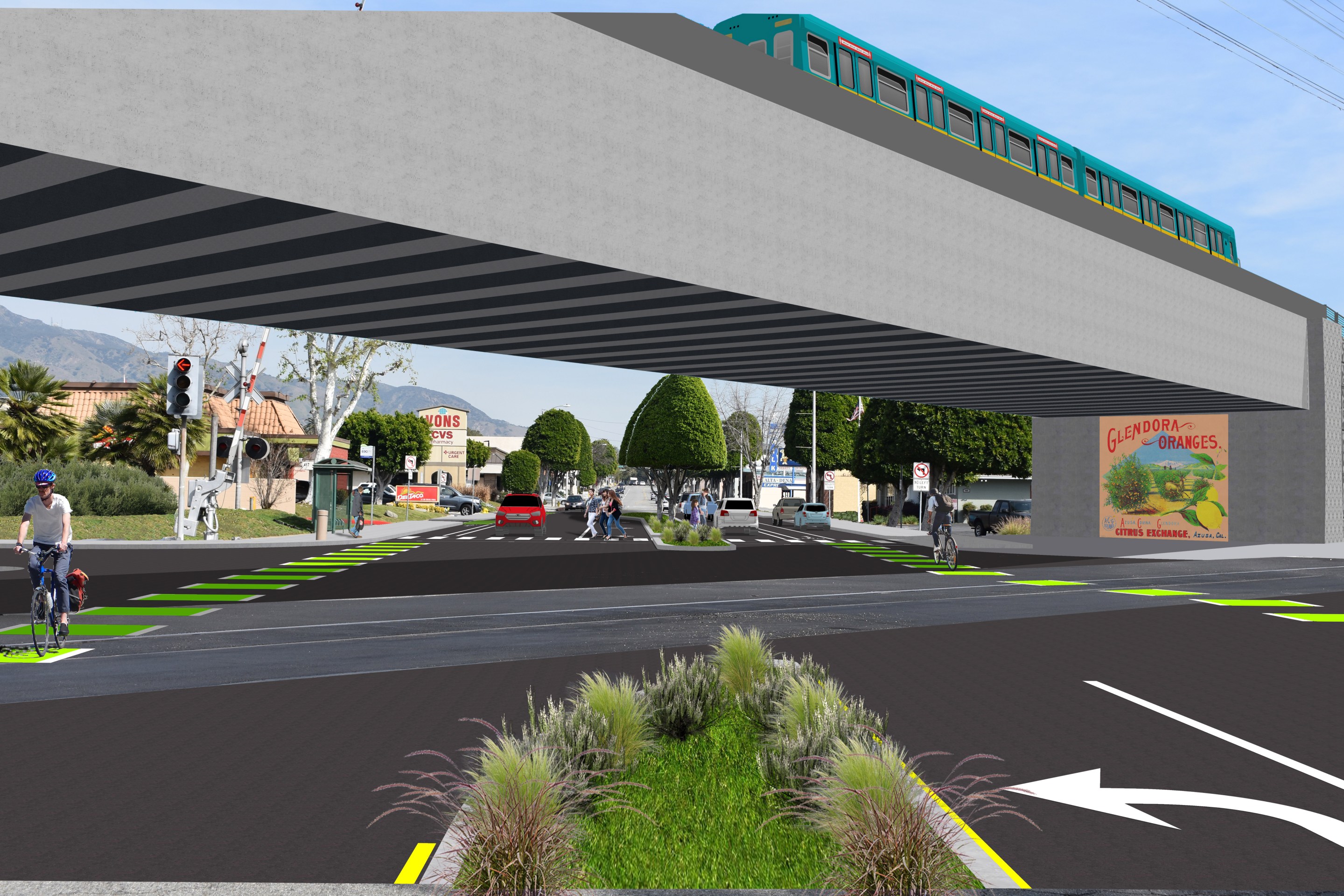
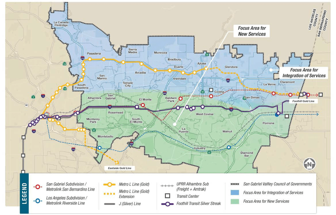
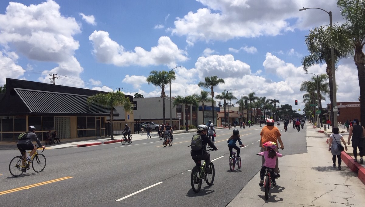
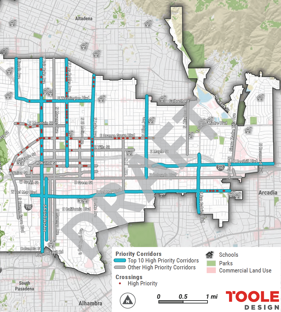
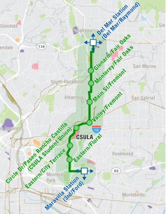
Seven-City East SGV Project Recommended for $15 million for Bike/Ped, Bus, and First-Last Mile Measure M Funding

By Kristopher Fortin | Dec 2, 2021 | No Comments
The East San Gabriel Valley Sustainable Multimodal Improvement Project would span Azusa, Claremont, Covina, Glendora, La Verne, Pomona, San Dimas
Study area of the San Gabriel Valley Transit Feasibility Study. The south (green) portion is being studied for new projects and the north (blue) area is being studied for projects that should integrate with currently existing mass transit options like the Metro L (Gold) Line. Image: San Gabriel Valley Council of Governments

Update: Outreach Activities Expected in 2022 for South SGV Mass Transit Study

By Kristopher Fortin | Nov 24, 2021 | No Comments
The San Gabriel Valley Transit Feasibility Study is the first step to tapping into the $635 million for mass transit solutions in the South San Gabriel Valley. The study is expected to be completed by May 2022.

SGV Connect 87 : A New Cartography of Greater El Monte

By Kristopher Fortin and Damien Newton | Nov 4, 2021 | No Comments
Kris interviews Romeo Guzman with the South El Monte Art Posse
Load more stories
      • Contact
      • Staff & Board
      • Our Funders
      • Ways to Give
      • Comment Moderation Policy
      • Streetsblog Los Angeles Editorial Independence Policy
      • Donor Transparency Policy
        Follow Us:
      • Facebook
      • Twitter
      Streetsblog LA Logo