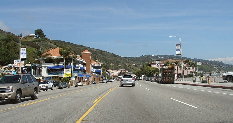
Last week, the City of Malibu released a draft study addressing safety issues on the 21 miles of Pacific Coast Highway (PCH) that runs through the city. The release coincided with the launch of an online survey to garner feedback from the public on a series of possible safety improvements.
The 65-page report was prepared by the Irvine-based consultant firm LSA Associates. It lists 80 potential safety issues and lists solutions in order of importance. A list of all the strategies suggested in the report can be found at the bottom of the article.
The report's proposed solutions are mostly about freeing the PCH somewhat from its car-dominated status, including the addition of 21 miles of bike lanes, adding parking meters to parts of the road, and adding more crosswalks and signage at unmarked crosswalks throughout the corridor. Improved access for disabled passengers at bus stops, and improved line-of-sight for drivers at some of the wavier parts of the road are also suggested. The PCH currently has seven lanes, two wide shoulders (sometimes used for parking) four mixed-use lanes, and a center turn lane.
"They're really trying," says Hans Laetz, a journalist and historian who is working on a book on the history of the PCH. "The $64,000 question is will the city council have the political will to do this. These will be some very very difficult issues for the City of Malibu."
Laetz announced Malibu's launch of this study on Streetsblog in 2011 and recently ran an unsuccessful campaign for City Council.
Things have changed in Malibu's government since 2010, when Safety Commissioner Susan Tellem started a Facebook page begging the California Highway Patrol to target cyclists for tickets. Cyclists swarm to the PCH in many beach towns, drawn to the road itself for training, transportation or recreation.
For more, visit Santa Monica Next.