How Ciclavia Can Inform Implementation of the Los Angeles City Bike Plan
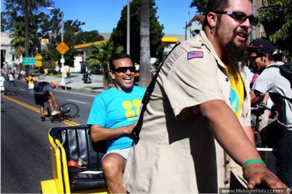
The week after Ciclavia I find it hard to settle my mind from the sights and sounds and motion of magical urbanism on the streets of Los Angeles. But, alas, the mundane world of traffic, work, and policy beckons. To ease the transition, I’m trying to focus in on what the key policy lessons of Ciclavia are for the region’s transportation system. For me, the overwhelming ‘meaning’ of Ciclavia is that a wide range of people will throng to streets if they can bike and walk without having to share space with cars.
So how can the freedom and inclusion of an open streets event be cultivated as the norm in our city, rather than the exception?
Sunday afternoon, after Ciclavia was over, people were playing basketball and sitting out in the recently-opened Sunset Triangle Plaza in Silverlake, which transformed approximately 250 feet of driving lanes on Griffith Park Boulevard into public space. How can we make more than .00065 percent of the 7303 miles of streets in the City of Los Angeles into good places?
Municipalities throughout the world employ a range of designs and policies to keep cars out of portions of cities, reduce driving speeds and reassign space in public rights of ways from cars and trucks to people. The City’s revision of the mobility element of its general plan could be a good process to try to shift away from car dominated streets in Los Angeles.
In this piece I mainly want to focus on lessons for the City’s 2010 Bicycle Plan. The plan will add up to 1683 miles of bikeways, consisting of a 719 mile backbone bikeway network of bike lanes on major streets; an 825 mile neighborhood bikeway network on less-trafficked streets; and a 139 mile green bikeway network of bike paths.
It turns out that the obvious experiential takeaway from an event like Ciclavia – separating cars from cyclists boosts the number and types of people willing to ride bikes – is strongly supported by cycling trends between different countries and between different cities in the same country. Comparing developed nations, residents of Belgium, Denmark, Finland, Germany, the Netherlands and Sweden make five to ten times more of their trips by bike than do people in Australia, the United Kingdom, and the United States. Women, the elderly, and children also make up a higher percentage of cyclists in these bike friendly countries.
The main cause of these disparities is that bike-friendly places design infrastructure for cycling differently than do bike-unfriendly places like Los Angeles. As Peter Furth summarizes the evidence in the forthcoming book City Cycling, edited by John Pucher and Ralph Buelher:
“Cyclists willing to ride in heavy traffic represent a small fraction of the population… At a global level, the correlation is strong; in every country with high levels of bicycle use, bicycle infrastructure that separates bicyclists from fast and heavy motor traffic is widespread, while in countries lacking routine separation, bicycle use is low.” By separation, he means physically separated bike lanes or cycletracks.
So how does the City’s bike plan rate in achieving enough separation between bikeways and automotive traffic to promote a growth in cycling by riders of all levels of ability, perceptions of risk, ages and genders? The greenway bike path network will be fully separated but will mainly follow the river, coastline and some transit lines. The 2010 bike plan wisely acknowledges that this network must be linked in to the other networks to allow for it to expand utilitarian riding in addition to being a recreational asset.
The plan’s on-street networks will consist of painted lanes on major streets as the backbone of the system, and traffic-calmed residential and commercial streets as the neighborhood network, a kind of alternative to (and extension of) the backbone.
The bike friendly streets of the neighborhood network hold potential as routes where bikes could safely share the road with cars because these streets can be designed to limit how fast cars drive. International best practices would suggest speed limits below 25 mph; traffic calming measures like very narrow lanes, speed bumps and frequent turns and/or roundabout, speed bumps; and no center lane markings. The 2010 bike plan contains a range of such treatments. It will be up the City, advocates and residents to ensure that every street in the neighborhood network is designed to allow safe cycling alongside car use.
Where I think the bike plan falls short is in the backbone network. There are two problems with the design of the backbone. The first is that it relies on painted lanes, which are substandard bike facilities compared to international best standards. The second flaw, which flows from the first, is that the backbone is designed as a form of de-facto discrimination against a majority of the residents of Los Angeles. The plan states that:
“It is expected that the Backbone will initially be used primarily by experienced riders who are comfortable riding close to moderate to heavy traffic volumes. However, in time, by resolving the perceived and actual dangers to bicyclists on arterials, the Backbone streets may become more accessible to riders less comfortable with greater traffic volume.”
Think about it. Would a new freeway or street ever be designed to be safe for only a narrow demographic slice of licensed drivers to use? Would a new transit line be designed to be safe for only some members of the public to ride on? It’s unthinkable. So why should cyclists accept bad facilities? True, bad facilities can be better than none, but we should be aiming for a safe, world-class network.
One of the best feelings at Ciclavia is seeing kids out riding with their families and noticing folks out on bikes who look different than the 1-2 percent of L.A. residents who regularly cycle. So it is a good idea to have an extensive neighborhood network as a parallel system for those who don’t want to ride anywhere near car traffic. But this should be their choice; new or young or older cyclists shouldn’t be kept off of arterial streets by design.
For the backbone system to be a true backbone worthy of a diverse city like Los Angeles, it must be accessible to all cyclists. Painted lanes may be appropriate as a short term measure to rapidly ‘mark out’ the network. Los Angeles’ backbone system should however be built for the long term with separated lanes or cycletracks, which, where they have been implemented, have a proven track record of being used by cyclists of all ages, genders and abilities. Separated bikeways will also attract more new riders, which will make cycling safer for all.

Streetsblog has migrated to a new comment system. New commenters can register directly in the comments section of any article. Returning commenters: your previous comments and display name have been preserved, but you'll need to reclaim your account by clicking "Forgot your password?" on the sign-in form, entering your email, and following the verification link to set a new password — this is required because passwords could not be carried over during the migration. For questions, contact tips@streetsblog.org.