
First Steps in Culver City, Connecting Downtown to the Expo Station
(This week L.A. Streetsblog will be looking at the projects completed as part of a PLACE Grant awarded to Culver City in 2008. Part of that grant was a "physical project" that would demonstrate the city's committment to creating a more bicycle and pedestrian friendly atmosphere. Don't forget to tag any responses with #ccsb.)
As part of every PLACE Grant, each of the five municipalities had to complete a physical project to demonstrate the goals of the grant. The main goal of Culver City's grant was to create the Bicycle and Pedestrian Initiative, the city's first serious attempt to do long-term planning for bicycling and pedestrian projects. However, the city also needed to complete a "Downtown Connector" that would provide safe and comfortable passage for cyclists and pedestrians between the future Expo Line Station and Downtown Culver City. The city just completed the connector project in the last several weeks.
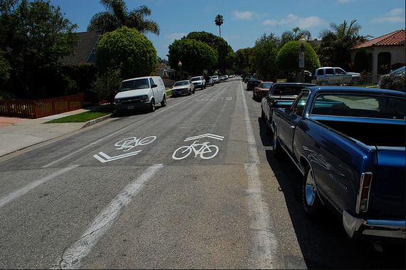
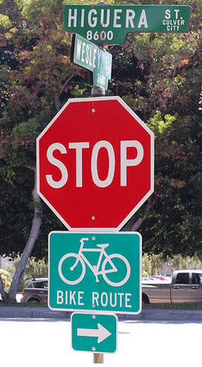
City officials chose to create a bike route from the station to the east and Downtown Culver City. The route is complete with informational and directional signage and Shared Lane Markings (Sharrows) on the road where appropriate. The 1.1 mile route begins at the signalized intersection of Wesley Street and National Boulevard and snakes down local roads Wesley Street, Higuera Street, Lucerne Avenue, and Irving Place before ending at Culver Boulevard in the east end of Culver City's Downtown. Going the other direction, the connector starts at the intersection of Culver and Van Buren Blvd. before turning east on Lucerne. Both Van Buren and Irving are one way streets.
John Rivera, the PLACE Coordinator for Culver City, explains that the project is about more than just connecting two fixed points. "The physical project is designed specifically to aid movement from the East Culver City Area to the Downtown Culver City Area and the city as a whole. It is informed by the plans that are being developed as part of the Expo Light Rail/Bikeway project which connects the Ballona Creek Bike Path to the area around the Expo Station."
For many cyclists, this comes as a welcome addition. "My biggest complaint as a bicyclist in Culver City is that riding into and through our Downtown is difficult," says Dino Parks, a member of the city's Citizen Advisory Committee for the Bicycle and Pedestrian Initiative.
Parks explains that the Connector is about more than just connecting two fixed points. "By design it connects 2 major destinations, but also has further potential. At Lucerne and Van Buren, it is 2 blocks from the Duquesne entrance to the Ballona Creek Bike Path. Also the potential exists to extend the route along Duquesne to Farragut and over to the Culver City Education Complex at Elenda. Once extended, it would be a bike route to 4 schools." The current Connector goes directly past Linwood E. Howe Elementary School near the western terminus of the project.
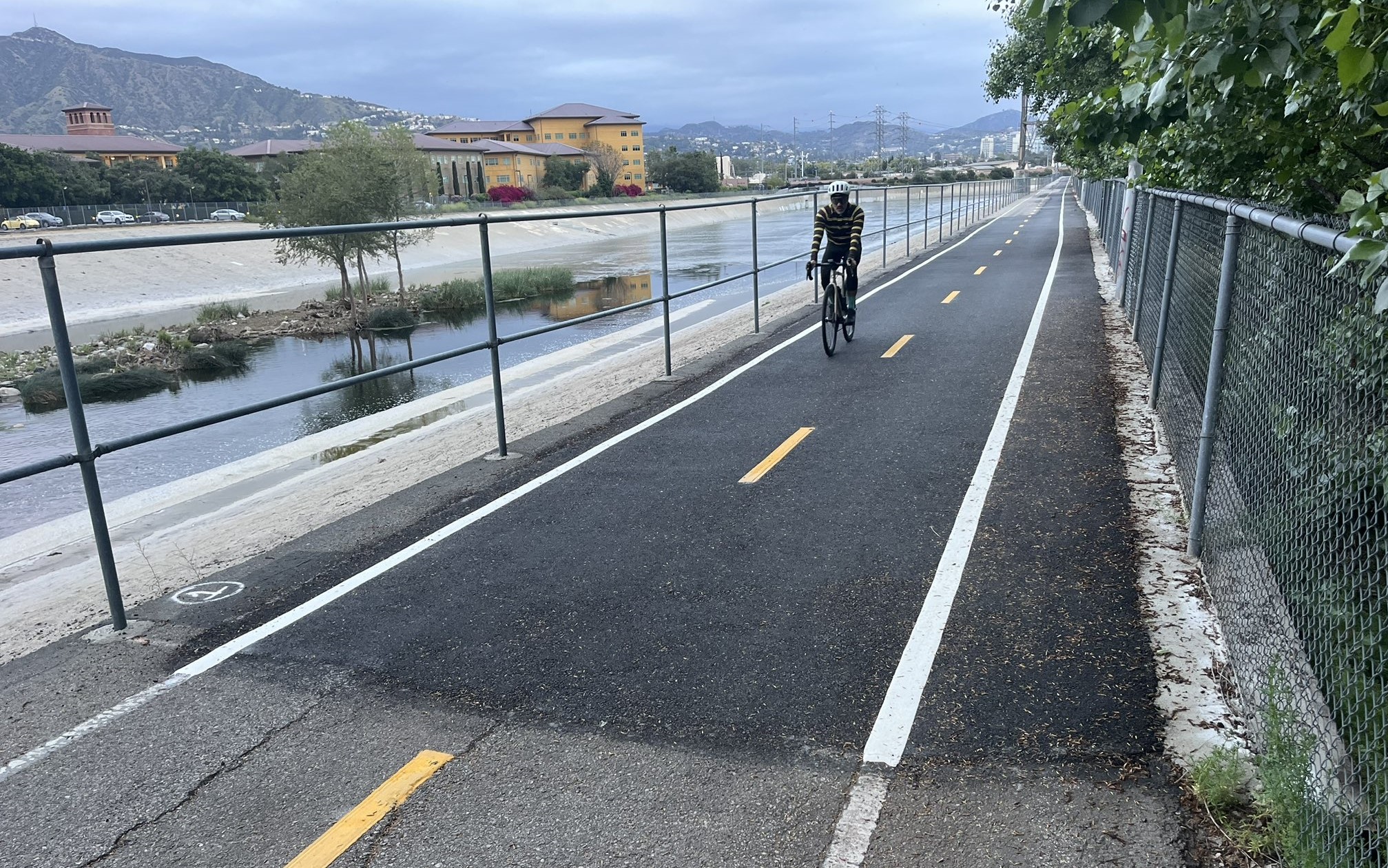
Before this project was completed, Culver City had just under four and a quarter miles of bike facilities total, including two and a half miles of Ballona Creek Bike Path, one mile of bike lanes in the northern boundary of the city, and .72 miles of bike path along Culver Boulevard. This Downtown Connector is 1.1 miles long and provides a template for the "Bicycle Friendly Street" concept outlined in the Bicycle and Pedestrian Initiative.
Yet, Parks and some other cycling advocates aren't completely satisfied with the project. There was debate between city staff and many of the members of its citizen advisory committee on whether or not the selected route makes the most sense for a bicycle and pedestrian connector. Advocates want to see a better connection for non-motorized transportation options along Washington Boulevard, the largest street that runs all the way from the east to west boundaries of the city.
"Downtown is my neighborhood," says Meghan Sahli-Wells, the Chair of the Culver City Downtown Neighborhood Association and another member of the advisory committee. "I like the Downtown Connector, but we need to get serious about Washington Boulevard."
A route down Washington Boulevard would be significantly shorter than the winding route down local streets. However, to avoid placing novice cyclists who might use the Expo Line for a day trip to Culver City or residents who are just learning or re-learning how to ride, in with regular traffic, bike lanes that would require removing mixed-use lanes would be required. Consider maps of the two routes:
View Larger Map
Removing mixed-use lanes is a major political lift, and one that Culver City isn't ready to make, at least as this point. None of the projects in the newly-passed Bicycle Master Plan require lane removal, and the plan for the Downtown Connector was created before the outreach plan created an active constituency for bicycling projects.
One of those cycling advocates, Darren Kessner, a former member of the advisory committee and a founding member of the Culver City Bicycle Coalition gives both sides of the argument. "Most cyclists would probably prefer to ride on Washington Blvd. with a bike lane. But this is a nice and easy way to get into Culver City.”
But Rivera and Culver City planners take issue with the idea that "most cyclists" would prefer bike lanes on Washington Boulevard. "The idea is to get more people out on bikes that wouldn’t normally try it. Most of those people aren’t going to be comfortable getting on Washington Boulevard. We even heard people say they didn’t like walking on Washington Boulevard with the volume of cars going by and the proximity (of the cars) to the right-of-way."
Rivera continues, "The route that we did services cyclists. It services pedestrians. It connects people to their schools in a more direct fashion. It provides more direct access for people to their schools It serves the community better than just putting bike lanes on Washington...But, we couldn’t put a bike lane on Washington unless we take right of way."
So how is the route?
Streetsblog completed two site visits to the physical project and rode it on a bicycle and drove through in a car. On the east end of the project, the sidewalk bumps in to the street calming car traffic and sending a message even clearer than signs on the roadside or markings on the street that this is a street that is safe for the community and for the people traveling through the area. Despite the couple of turns, the ride was as safe and easy on the bicycle as it was in the car. The route seems an excellent one for novice riders, even if it is a seemingly unnecessary detour for those more experienced.
It's hard to get a perfect read on whether or not the project is "working" at this point because the Expo Station hasn't opened yet and won't open until early 2012.
However, one area where the new project falls short is that once cyclists reach Downtown, they are dropped on to Culver Boulevard without great facilities on the street or adequate bike parking. Rivera even admits that many bike parking facilities in Downtown aren't well marked and are hard to find but also provides hope that there is a plan to make things better for cyclists looking to park their bikes.
Damien Newton wrote this story while participating in The California Endowment Health Journalism Fellowships, a program of USC’s Annenberg School for Communication & Journalism.
Stay in touch
Sign up for our free newsletter
More from Streetsblog Los Angeles
Metro Board Funds Free Student Transit Pass Program through July 2025
Metro student free passes funded another year - plus other updates from today's Metro board meeting

Eyes on the Street: New Lincoln Park Avenue Bike Lanes
The recently installed 1.25-mile long bikeway spans Lincoln Park Avenue, Flora Avenue, and Sierra Street - it's arguably the first new bike facility of the Measure HLA era

