LADOT Announces 20 Miles of New Sharrows for 2014
Via an article published yesterday in the LADOT Bike Blog, the department announced that it would be adding "approximately 20 miles" of "new sharrows... over the course of the next year." The article includes a spreadsheet listing of where these sharrows will be implemented.
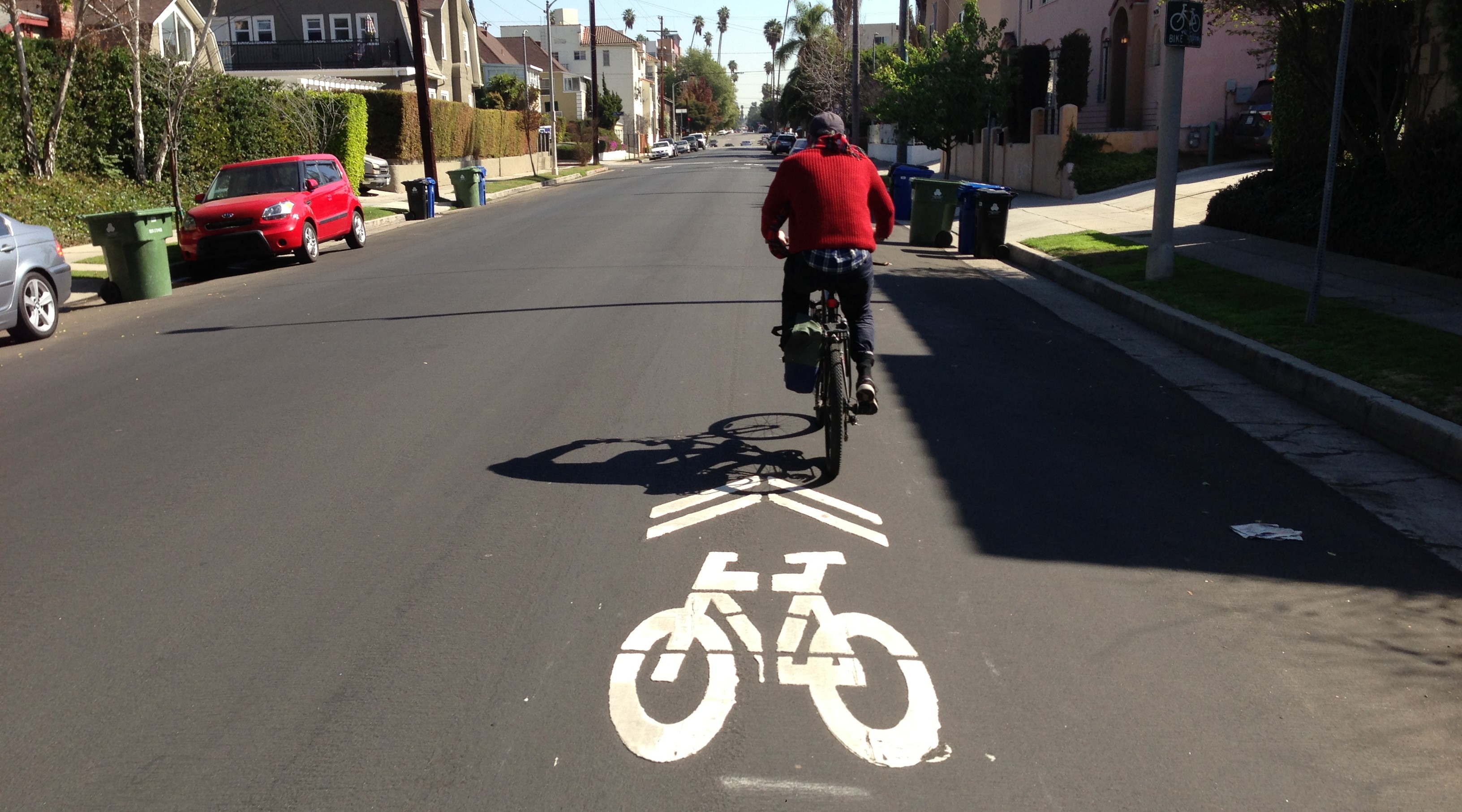
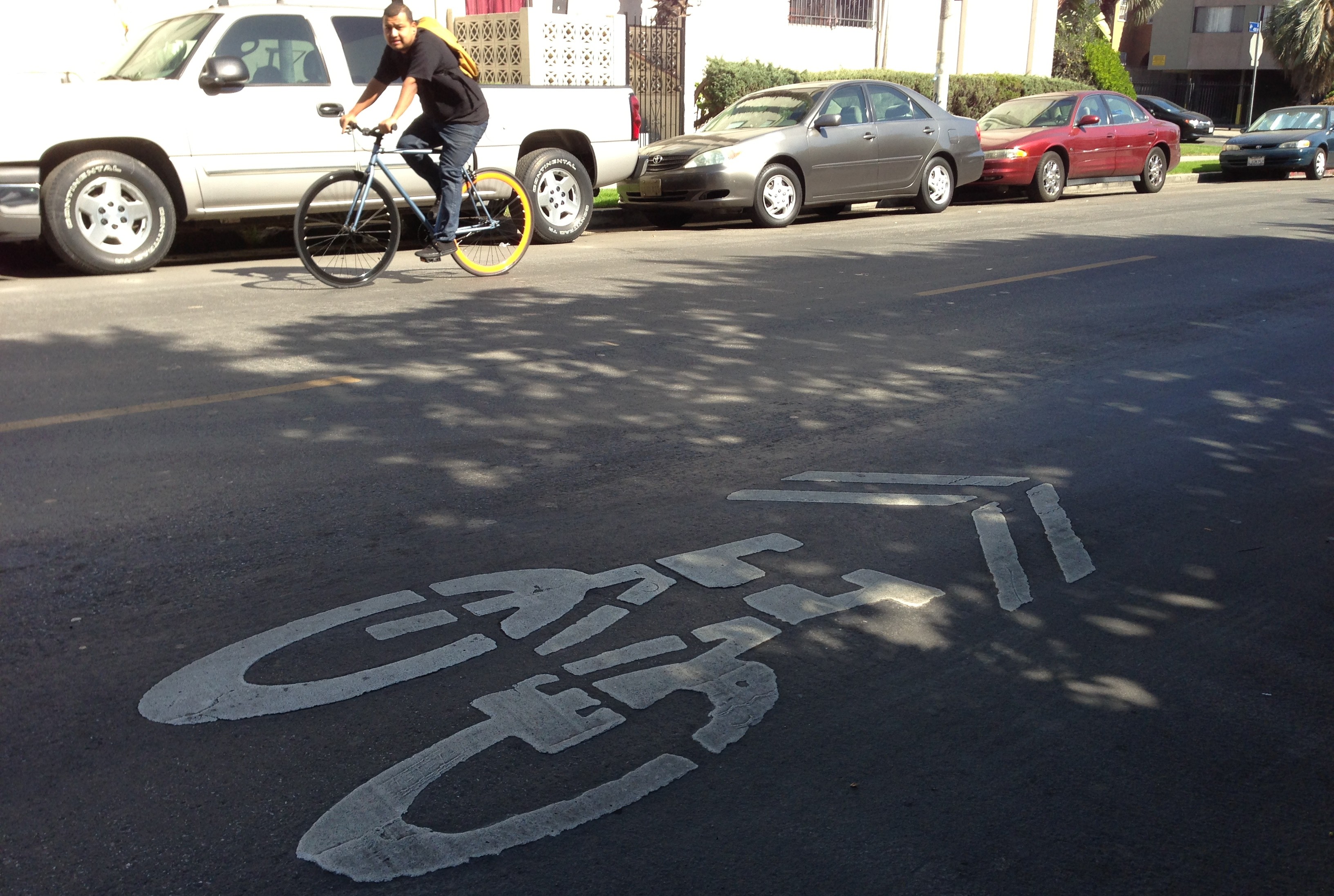
In case readers are unfamiliar with them, Sharrows are shared lane markings. They designate lanes that are shared by bikes and cars. Sharrows are generally the lowest of the low-hanging-fruit, useful where squeezing in a more robust bike facility is difficult. They don't take any parking, any lanes, any inches, any time away from cars. They are just a reminder to drivers that bicyclists will be on the street and tell bicyclists where to ride to stay out of the "door zone."
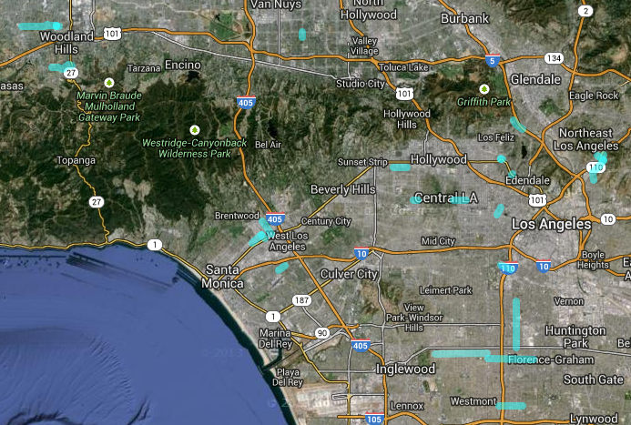
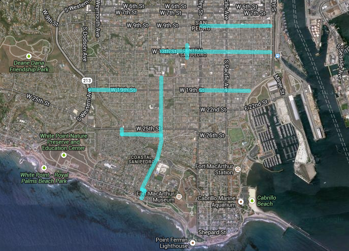
Streetsblog used Google to map the 20 mile list - click here or on the images to go to the actual Google Map. Here's most of L.A. City:
And here's a detail for San Pedro, which is receiving plenty of the new sharrows:
Streetsblog hasn't had time to bike out and measure all of these streets, but, after a preliminary review, it looks pretty good.
The list includes mostly 2-lane residential streets that are already fairly convenient and safe to bicycle on. Many of these are existing bicycle routes, some that wiggle through neighborhoods. Sharrows are useful in this wiggle-context to act as a sort of bread crumb trail designating a good trajectory to follow. Some of these neighborhood routes include:
- Hatteras-Capistrano-Miranda in Woodland Hills
- Griffin-Avenue 43-Mosher (with Arroyo Seco bike path) in Highland Park / Montecito Heights
- Texas-Westgate in West L.A.
- 108th Street and 79th-76th in South L.A. (both of which are relatively low-traffic streets that get across the 110 Freeway)
There are quite a few gap closures between existing facilities. This, too, tends to be another good place for sharrows. Gap closures include:
- Rampart Blvd: connecting existing bike lanes on Rampart and on 7th Street
- Woodman Avenue: connecting existing bike lanes on Woodman and on Chandler
- Santa Monica Blvd / Manzanita Street: connecting existing bike lanes on Sunset and on Santa Monica Blvd
One odd inclusion on a "new sharrows" list is 4th Street in Koreatown-Hancock Park. 4th Street already received sharrows in 2010, so these certainly wouldn't count toward new mileage. LADOT's 2014 list includes two stretches of 4th Street: Oxford to Norton, and Cochran to La Brea.
As of this morning, there still are sharrows on every block of 4th Street from Oxford to Norton.
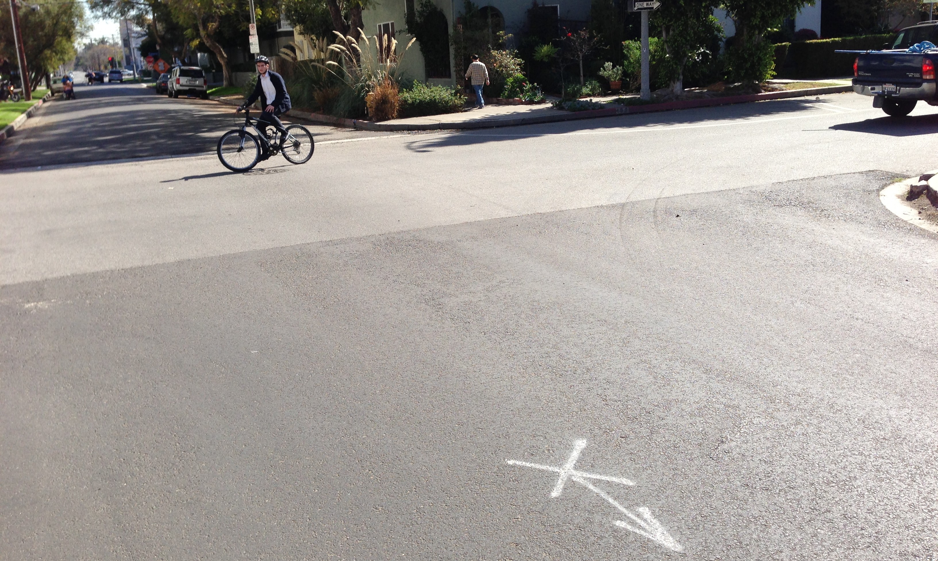
It appears that 4th Street from La Brea to Cochran was recently resurfaced. The sharrows that were there are gone, but there are preliminary sharrow placement markings - a sort of X with an arrow (see below.)
One opportunity that appears missing in the LADOT 2014 sharrow list would be asymmetrical treatments, generally most useful on somewhat hilly streets. Sharrows can be added in the downhill direction, with a bike lane going uphill only. The sharrow/lane facility is apparently common in Seattle. Los Angeles only very rarely uses asymmetric lane/sharrow treatments, generally at bottlenecks where streets narrow for a short distance, including Burbank Blvd and Laurel Canyon Blvd.
There are few hilly streets in San Pedro, also Federal Avenue, maybe others, where there may be width to add just one 5-foot bike lane in the direction where it's most needed.
Streetsblog will continue to monitor and analyze bikeway implementation throughout the region.
Stay in touch
Sign up for our free newsletter
More from Streetsblog Los Angeles
Automated Enforcement Coming Soon to a Bus Lane Near You
Metro is already installing on-bus cameras. Soon comes testing, outreach, then warning tickets. Wilshire/5th/6th and La Brea will be the first bus routes in the bus lane enforcement program.


Metro Looks to Approve Torrance C Line Extension Alignment
Selecting the relatively low-cost hybrid alternative should help the oft-delayed South Bay C Line extension move a step closer to reality