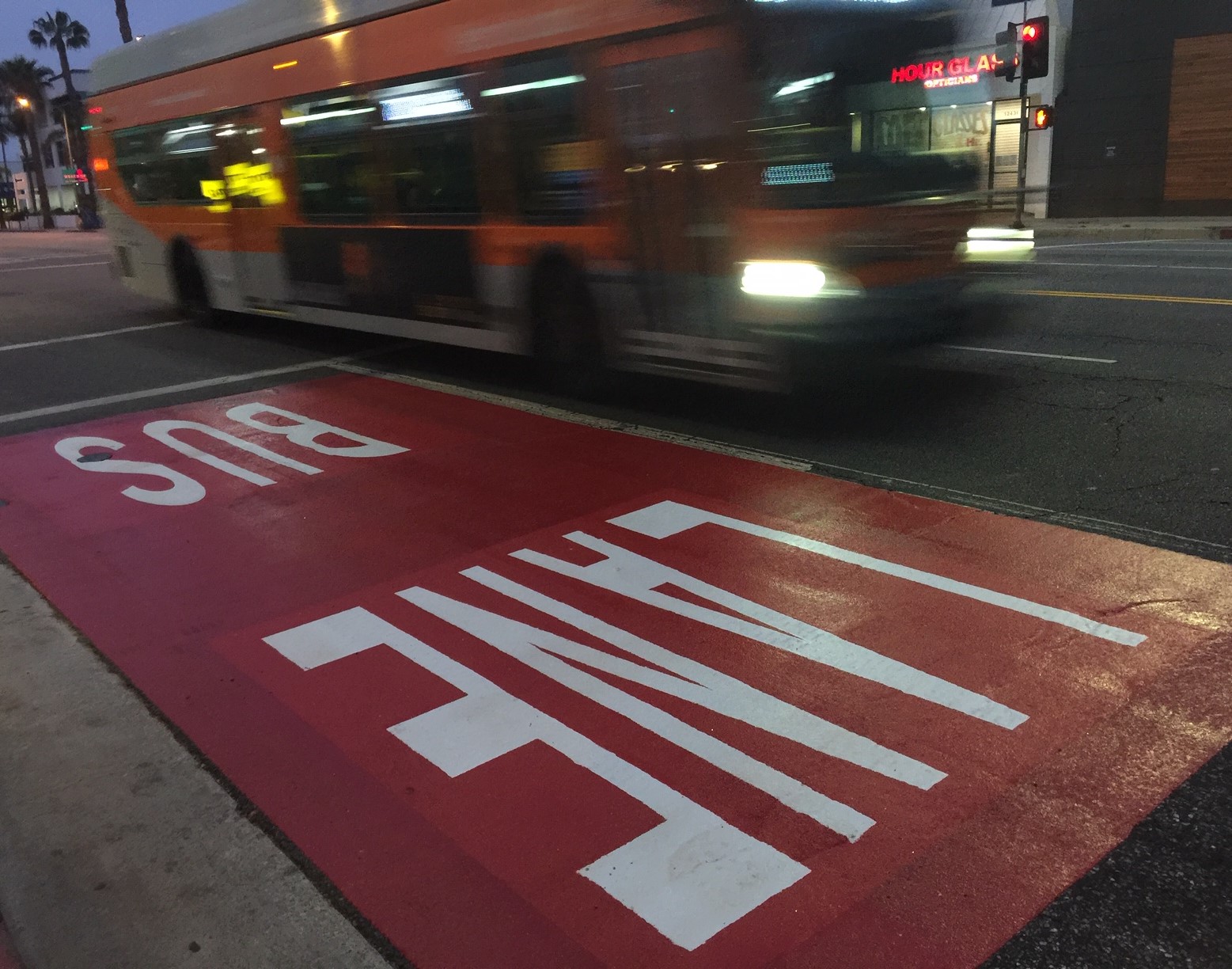
Orange Line Bridge To Speed Up BRT Buses, But What’s Underneath?
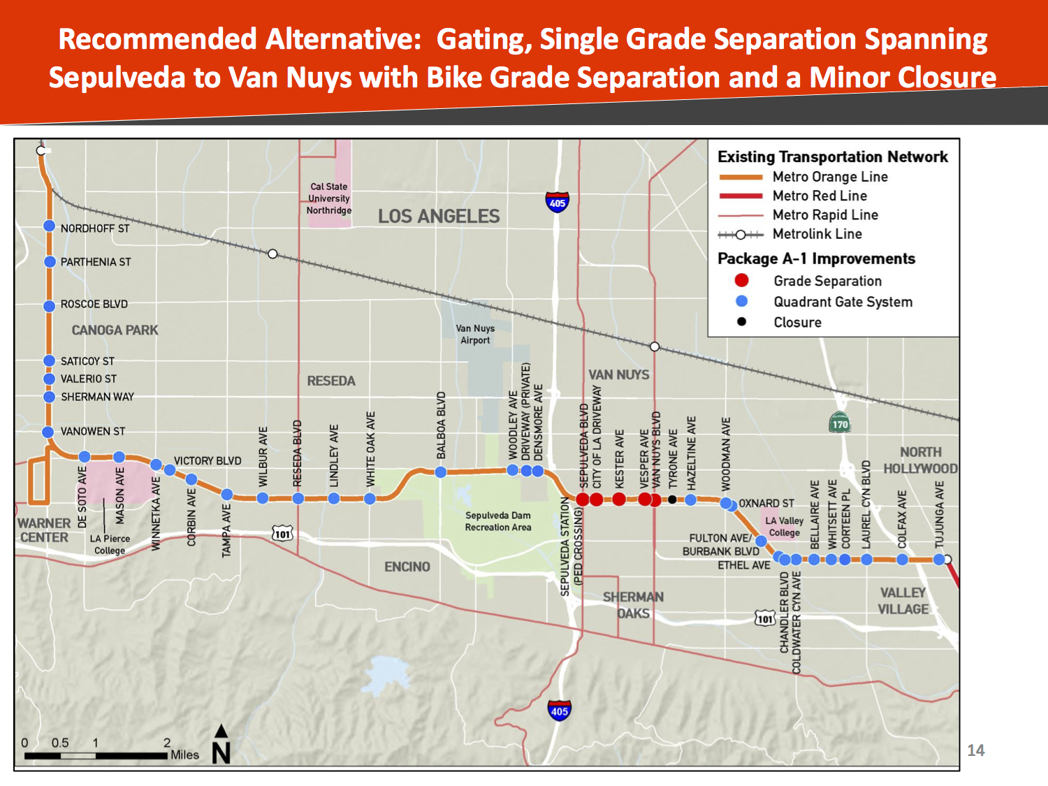
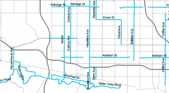
Metro’s map of planned Orange Line improvements

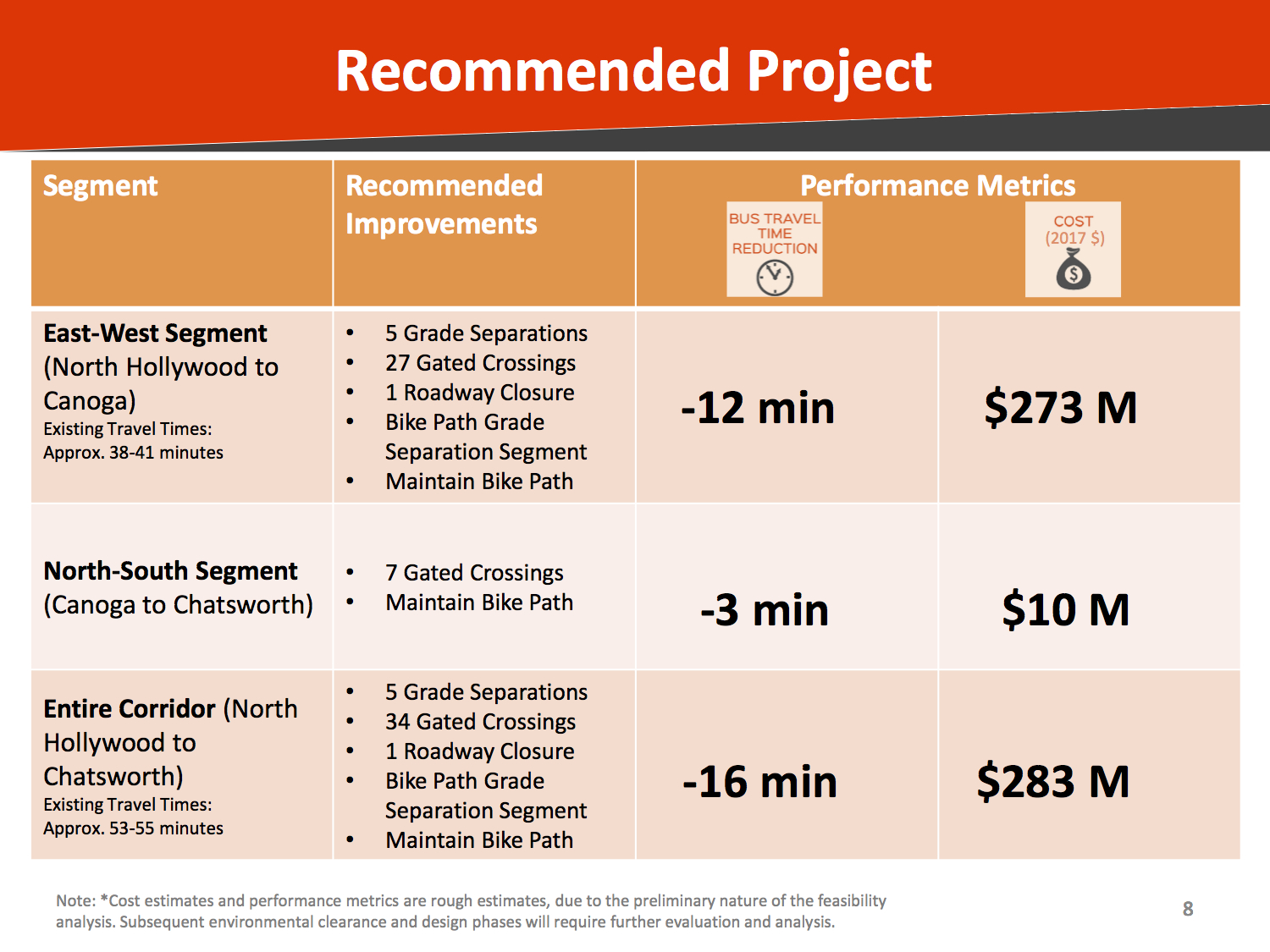
Earlier this week, Metro announced plans for new infrastructure to speed up its Orange Line Bus Rapid Transit. The agency is proposing a mile-long bridge that would extend from Van Nuys Boulevard to Sepulveda Boulevard. The project would also add rail-type crossing gates at 34 intersections.
The bridge, combined with the gated crossings is estimated to cost $283 million, and result in a 16-minute time savings for buses traversing the line. Funding for Orange Line grade separation is included among the early projects in Measure M. Metro reports that, after environmental clearance just getting underway, the project is expected to be built by 2025.
There is further Measure M funding to convert the Orange Line BRT to rail, though that is not scheduled until the 2050s.
At this point, not a lot of details have been made public. The Source shares two slides from a not-yet-released slideshow summarizing a not-yet-released report. Streetsblog, Urbanize and The Daily News all cribbed from those two slides.
On the face of it, the project sounds great. Faster buses will improve the quality of life for 30,000 daily riders. Focusing on the mile-long bridge lays groundwork for eventual conversion to rail. Doing that for about $300 million is cheap compared to most Metro highway and transit projects.
The angels may be in the details of what happens underneath that bridge - and what is prioritized there.
The under-bridge space could be designed in a way that prioritizes cars. Metro, working with LADOT, could choose to add parking lots, to add access roads, and/or to prioritize automobile cross-traffic at intersections. Getting the buses off the ground could free up the ground for more cars.
Alternately, the space could prioritize walking and bicycling.

Today, the Orange Line includes a parallel walk and bike path. The path is preserved in Metro's elevated BRT plan. Though the path is well-used by cyclists, runners, dog-walkers and other pedestrians, it also (like much of L.A. these days) experiences issues with homelessness.
The path is currently easily accessed to/from the north, but not the south. With the busway removed from the ground level, there are possibilities for opening up more and better connections for walking and biking. These would foster first/last mile connections for both the Orange Line and the future East San Fernando Valley transit project along Van Nuys.
Metro's plan includes a street closure at Tyrone Avenue, just east of Van Nuys Blvd, presumably where a bridge would be ramping up. Closing the street to cars, but keeping bicycle and pedestrian access could effectively create a bicycle boulevard.
Another potential walk/bike crossing point would be Cedros Avenue. The Orange Line busway is currently an obstacle in the way of implementing L.A. City's Mobility Plan 2035, which designated Cedros as a Neighborhood Network low-stress street where bicycles can comfortably share streets with cars. With the busway elevated, Cedros can be connected for cyclists and pedestrians.
Overall, spaces beneath large infrastructure, think freeways, can become nuisance-plagued no-man's lands. The space below an elevated busway (running electric buses by then) is not so ruined with air and noise pollution as space under a highway. Activating that space should be part of the overall design, not an afterthought. If Metro does not activate the space, homelessness and crime likely will. Features below the busway should not be so expensive as to break Metro's budget or delay the project, but, as with Metro's commitment to Transit-Oriented Communities, Metro can be a partner for projects that serve the community.
It is not up to a Streetsblog author to designate what the space should be used for; that should be part of Metro's community input process about to get underway. The corridor is already essentially a landscaped linear park, so a few relatively low-cost complementary features could include: basketball courts, a Metro bike hub (possibly including bike rental and/or bike-share), tot-lots, a skate park, community gardens, or modest scale park-serving retail such as a cafe (or spaces for street vending and/or food trucks). Thinking bigger, this is a Metro-owned right-of-way, so it could even be a potential site for some medium-scale transit-oriented housing.
Adding ground-level features will not necessarily be easy, but doing it up front should facilitate first/last mile transportation, minimize future nuisances, and build community.
Readers - what do you think of Metro's plans to elevate a mile of the Orange Line busway? What do you think should go underneath the elevated busway?
Stay in touch
Sign up for our free newsletter
More from Streetsblog Los Angeles
LAPD shoots, strikes unarmed unhoused man as he walks away from them at Chesterfield Square Park
LAPD's critical incident briefing shows - but does not mention - that two of the three shots fired at 35yo Jose Robles were fired at Robles' back.
Metro Committee Approves 710 Freeway Plan with Reduced Widening and “No Known Displacements”
Metro's new 710 Freeway plan is definitely multimodal, definitely adds new freeway lanes, and probably won't demolish any homes or businesses

Automated Enforcement Coming Soon to a Bus Lane Near You
Metro is already installing on-bus cameras. Soon comes testing, outreach, then warning tickets. Wilshire/5th/6th and La Brea will be the first bus routes in the bus lane enforcement program.