A Hearing and a Meeting on Boyle Heights Streets This Week
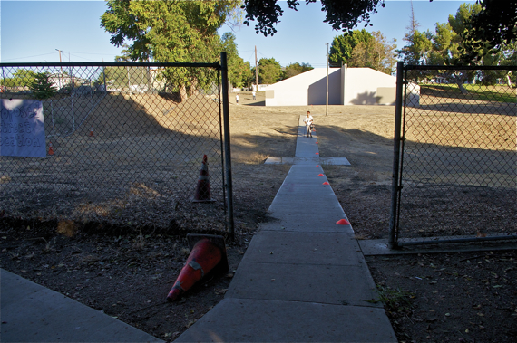
The Boyle Heights/El Sereno/Lincoln Heights communities logged a victory last fall when USC decided that they would not only reroute a road originally planned to connect Norfolk St. with Soto through Hazard Park (left), but that they would also vacate claims to that portion of the land by handing it over to the Dept. of Parks and Rec. and forgoing future development on that parcel.
It was a unique gesture of goodwill on the part of USC.
The parcel of land in question (the section of Norfolk between Playground St. and Soto, below) was not originally part of the park. But, it had been absorbed into the park by default over the years and handball courts were built on a portion of it.
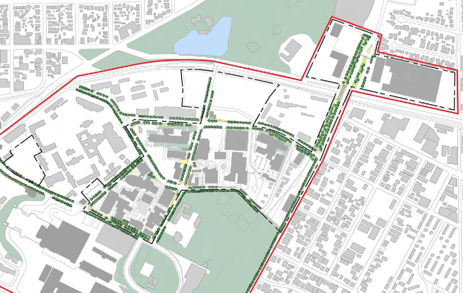
So, when USC met with the community last year to announce planned improvements, including the construction of a new clinic building, student housing, and a hotel on the health sciences campus (HSC), and that development of a parcel of land along Soto would trigger a mandatory extension of Norfolk through the handball courts, the community decried what they felt was a land grab.
Promises of new handball courts and other improvements did little to assuage people's outrage, fears of excessive traffic along Soto's already busy corridor, and worries about the encroachment of students (and their cars) into the residential areas across the way from the campus complex.
Seemingly dedicated to being better neighbors, USC has since committed to providing Hazard Park with a new jogging path, new outdoor fitness equipment, a new toddler play area, additional security lighting, $50,000 to support the park’s youth sports programs, and upgrades to the park gym, outdoor basketball and tennis courts, and restrooms. They have also committed to constructing 1,500 new parking spaces within the campus and working with the CD 14 office to secure additional metered parking for park-goers over the next several years.
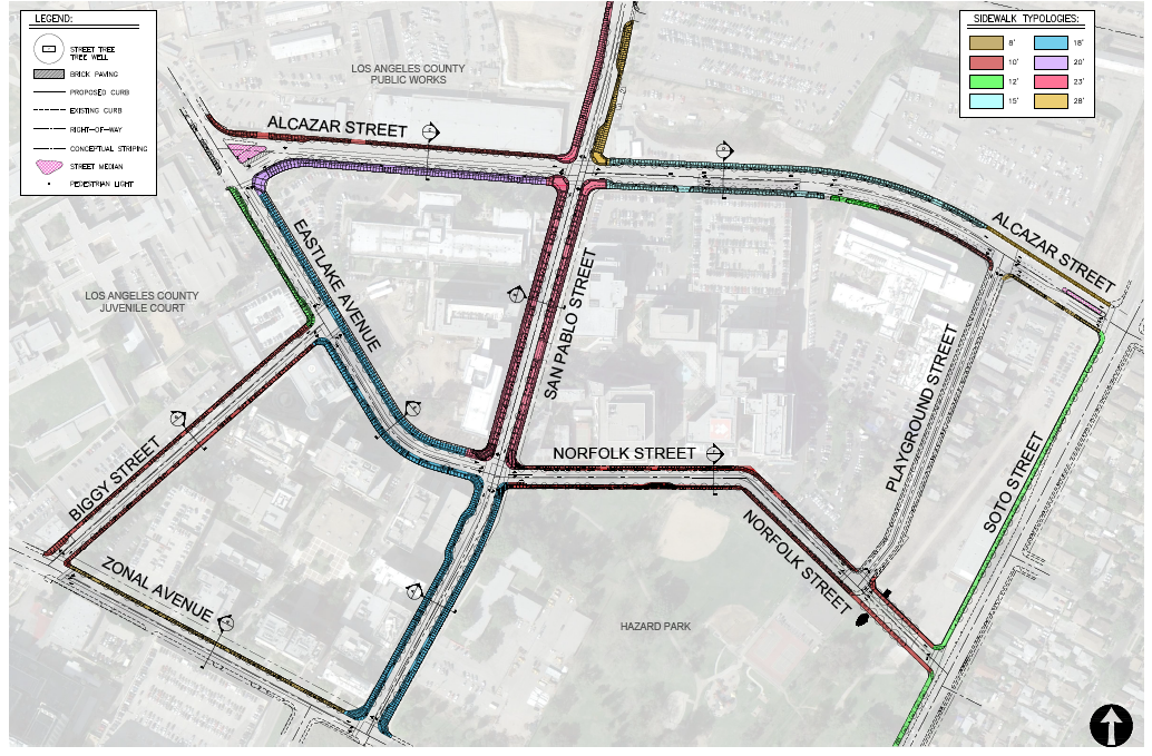
This Friday, February 7th, the process will take another step forward with a hearing before the Hearing Officer on behalf of the City Planning Commission at City Hall regarding the redesignation of the street classifications of San Pablo, Alcazar, Eastlake, Norfolk, Playground, and Biggy Streets (to facilitate beautification) and the streetscape improvements planned for each.
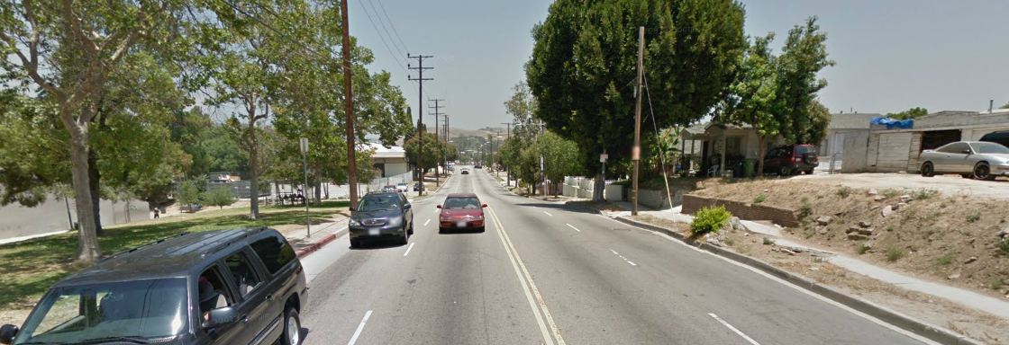
Things like the enhanced sidewalk along Soto will be a welcome improvement to the area.
Right now, there is no real sidewalk (aside from packed dirt/gravel and occasionally asphalt) on the west side of the street and vehicles sometimes park in that space.
The new sidewalk will also complement the bike lanes slated to run along Soto (between Huntington and 8th St.) that should be implemented later this year (for more information on that, see here).
It won't, however, do much for the lousy sidewalk on the east side of the street, which is narrow, crumbling, and uprooted in a number of places. At least, it is uprooted in the sections where there are trees. North of Hazard Park, there are very few. Meaning the disparity between the community and the campus will be quite apparent when the improvements have been made.
Speaking of bike lanes, it also seems odd that none are planned for the interior of a health sciences campus and park space (beyond the one planned for Zonal, to the south, which runs in front of the Bravo Medical Magnet school).
There are so few places kids can safely ride their bikes, and the quieter streets within the campus complex could make a wonderful place for families and even patients to ride bikes safely. And the sidewalks, while widened, do not appear to be planned to support bike traffic.
That oversight seems unfortunate, especially once it will be easier for cyclists to travel along Soto.
While USC students and staff comprise a large proportion of the traffic coming through the area, they are certainly not the only ones. Community members regularly cut through the area to get to the park, make their way to school, get to work, or have a quiet place to walk and ride away from the major thoroughfares that slice up the community.
Making space for cyclists might help improve the health of both the local community and the USC community, something that I would imagine med students should be in favor of.
If you'd like to learn more about the proposed plans, you can find them here (the hearing notice and diagrams) and here (USC's Master Plan) or attend the hearing this coming Friday, February 7, at 10:00 a.m. at City Hall (200 N. Spring St, Room 1010 on the 10th floor).
If you would like to learn more about the bike lanes proposed for Soto (and also for Boyle Ave.), you are invited to attend the Neighborhood Bike Ambassador meeting this Wednesday February 5th, at 6:30 p.m. at the Highland Park Rec Center (6150 Piedmont Ave inside the gym, community room).
*UPDATE 2/04/14: This story has been updated to note that the hearing will be before a hearing officer on behalf of the Planning Commission. The plans will not go before the Planning Commission until April or so.
Stay in touch
Sign up for our free newsletter
More from Streetsblog Los Angeles
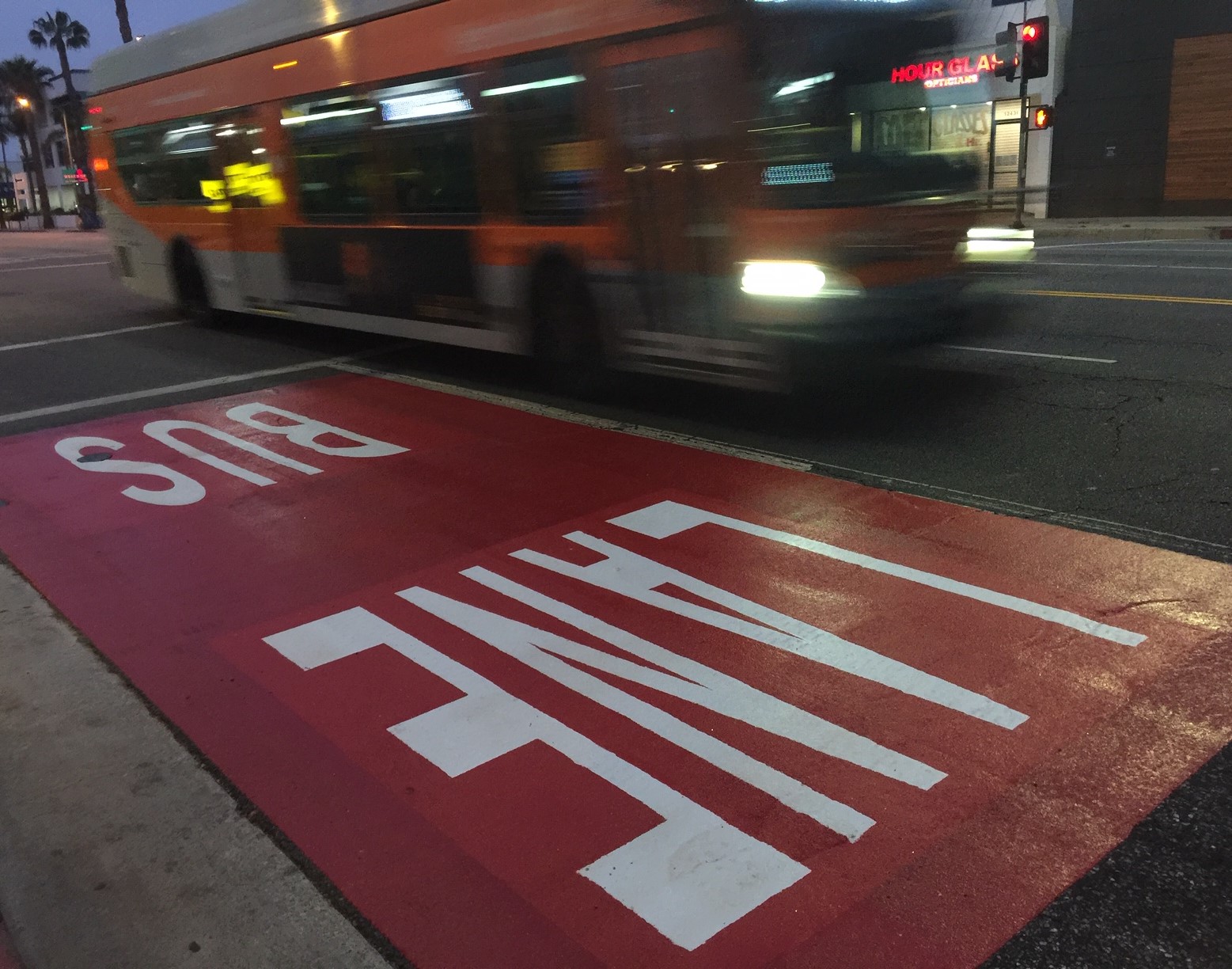
Automated Enforcement Coming Soon to a Bus Lane Near You
Metro is already installing on-bus cameras. Soon comes testing, outreach, then warning tickets. Wilshire/5th/6th and La Brea will be the first bus routes in the bus lane enforcement program.

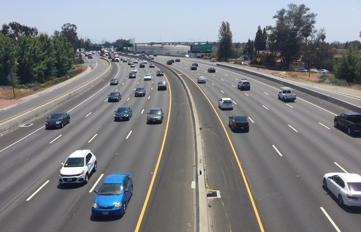
Metro Looks to Approve Torrance C Line Extension Alignment
Selecting the relatively low-cost hybrid alternative should help the oft-delayed South Bay C Line extension move a step closer to reality