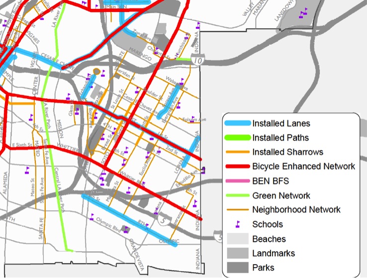
Which Boyle Heights Streets are the Best Candidates for Bike-Friendly Enhancements?
"Why the f--k does it smell like cat food??" I heard myself shout out loud to no one in particular.
I was out exploring the proposed bike-friendly streets of the area yesterday afternoon, when I turned south on Marietta St. in Boyle Heights, and got smacked hard upside the head by the stench.
Boyle Heights has had its issues with air quality. The battle over the right of the Exide battery recycling plant to continue operating drags on, even as new questions emerge about just what kinds of chronic hazards nearby residents are being exposed to. So, it is not unusual to catch a whiff of something strange every now and again.
But this was intense.
As I stood taking in the stench near the asthma-inducing tangled arms of the 5, 60, and 101 freeways, I thought that if the city was really serious about making Boyle Heights bike-friendly, or even simply human-friendly, they would be best advised to tackle some of these more detrimental environmental problems first.
"Does it always smell this bad?" I asked some youths throwing a football around in the street.
"Sometimes," said one. "Mainly when they are cooking up drugs."
Of course, I thought: Eau de arsenic and meth.
My favorite.
* * * *
I was touring the candidate side streets yesterday because City Planning is looking for input on the streets in the area that should be prioritized for bike-friendly enhancements.
And, although I am intimately familiar with the side streets of South L.A. and who can and cannot use them and why, Boyle Heights is another story altogether.
Because it is so chopped up by the river, industrial zones, freeways, hills, and t-intersections (meaning only a few streets will take you somewhere directly), I generally spend most of my time moving through the area on main streets like Cesar Chavez, 1st, 4th, and Soto. My observation is that most other people tend to do the same, especially if they are commuting or moving through the area on their way to downtown or East L.A.
I know some of the aversion to side streets may also be attributed to the fact that several of the candidate streets (namely St. Louis, Breed, and Michigan) can be problematic for local pedestrians who may find themselves either confronted by young knuckleheads who claim the streets as territory or by police mistaking them for knuckleheads.
Still, it's hard to know what kept people off the busier side streets yesterday afternoon. Even as the breeze picked up and long shadows made the streets feel refreshing, they were completely completely devoid of bikers.
My tour of the other candidate streets left me scratching my head a bit, too.
Either the stretches seemed so short that they seemed not particularly useful, like a mile-long stretch of 6th St. between St. Louis and Mott, or they went nowhere, like Gless.
Looking at the map, it is clear that the intention was to put enhancements along streets near schools or, like with the mile of 6th street, to make a connective bike-friendly network that linked to Hollenbeck and other parks. But many of those streets are already quite quiet and traffic is very localized.
I wondered if it wouldn't be better to dump funds into really enhancing streets that helped you move across the neighborhood, like Mott (which already has some sharrows and is a lovely ride), 4th (instead of 2nd? I can't help it--I love 4th), and Evergreen, which can be a little crowded and move pretty fast at rush hour but which is so important because it connects to the well-used cemetery walking path.

The other candidate bike-friendly side streets might be better served by pedestrian enhancements (better crosswalks, more lighting, better sidewalks) so people could get their kids back and forth to school or parks more comfortably. Especially because, if kids are riding bikes with their families to or from school, they tend to be doing it on the sidewalks.
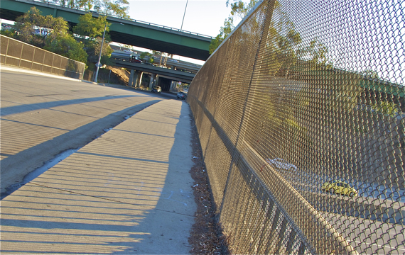
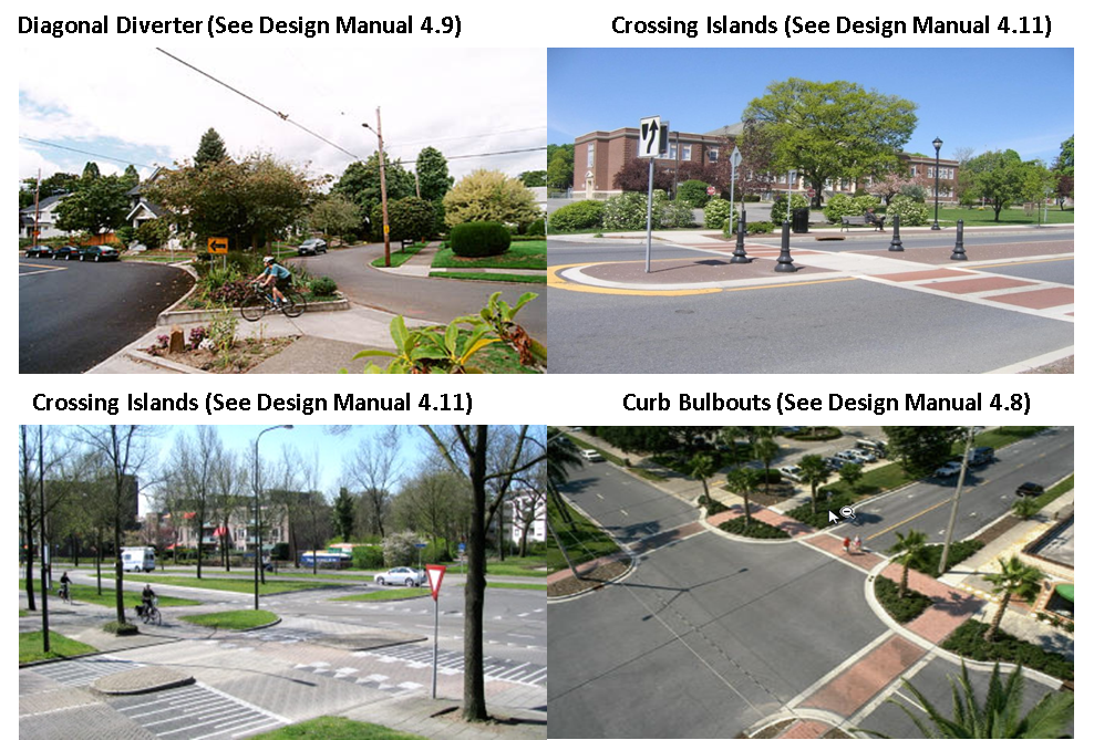
Moreover, some of the streets are so narrow and crowded with parked cars that it is hard to know how well the kinds of enhancements you might see on other bike-friendly streets would work in the area (see below).
I also wondered if we needed a side-street specific bike and pedestrian count to help us figure this out.
The counts scheduled for next week are intended to take a snapshot of typical movement patterns along more heavily-used corridors.
As such, they seem to be purposely scheduled to avoid school hours in the afternoon.
For the purpose of figuring out how to invest in bike- and pedestrian-friendly enhancements, however, targeting side streets areas during the hours school lets out might be the best way to capture the community's needs.
The timing matters because, in the morning, kids may arrive at school in a vehicle, brought by a parent rushing to work. After school, they are more likely to be picked up by a parent on foot. Or, they may walk home with groups of friends and stop by local stores or restaurants, chill in a park, or seek out public transit. In short, the truer picture of how streets are used by pedestrians and cyclists is more likely to emerge in the afternoon, when kids and parents alike are out in force.
But all these are the observations of someone who is still getting to know the intricacies of the neighborhood. They may not be as insightful as they could be. Or, they could be flat-out wrong.
So, I'm throwing open the question to the wider readership in the area. What side streets do you use to get around in Boyle Heights? Why do you like them? What about the ones you don't or won't use?
Current candidate streets can be seen in the map at the top of the article or you can download the map here. Feedback is more than welcome. You may comment below or send your thoughts directly to city planning's David Somers at david.somers@lacity.org.
Stay in touch
Sign up for our free newsletter
More from Streetsblog Los Angeles
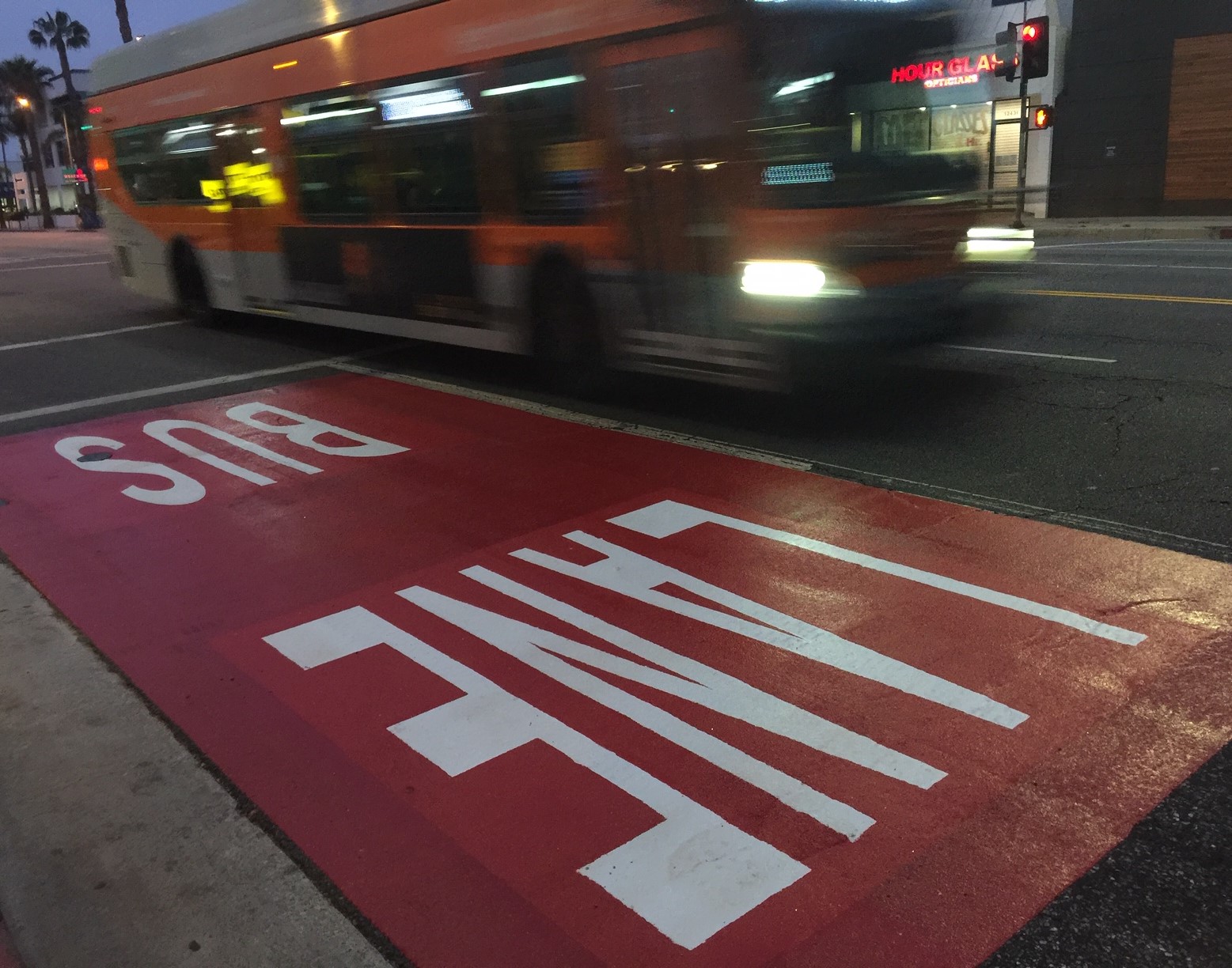
Automated Enforcement Coming Soon to a Bus Lane Near You
Metro is already installing on-bus cameras. Soon comes testing, outreach, then warning tickets. Wilshire/5th/6th and La Brea will be the first bus routes in the bus lane enforcement program.

Metro Looks to Approve Torrance C Line Extension Alignment
Selecting the relatively low-cost hybrid alternative should help the oft-delayed South Bay C Line extension move a step closer to reality